Ports and small yacht harbours
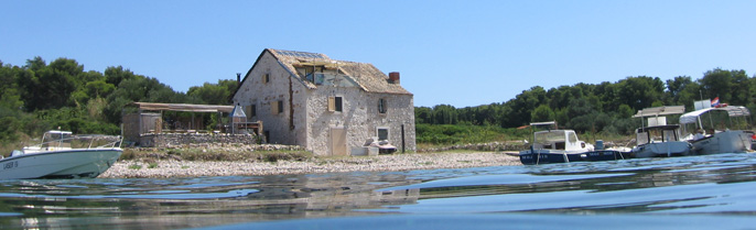
KRALJEVICA (45° 16’N; 14° 34’E), small town (pop. 2,987 in 1991) and harbour on S side of Bakar Bay between Fortica and Ostro points.
Approach: Landmarks: the old church belfry on Ostro point and castle on Fortica point; church belfry; hospital building on N shore; round green buoy (green light topped by cone) anchored NW of Ostro point at depth of 20 m; harbour light. South of Kraljev- ica the Krk Bridge links the island of Krk with the mainland.
Mooring: Beside the S shore of the harbour and the shore in front of the Frankopan castle yachts can use four-point moor or can lie with four-point moor north of the quay in Drazica cove. Smaller yachts can moor in Carevo cove N of the quay but here they are exposed to bora and maestral.
Facilities: Harbour master’s branch office, post office, hospital for bone tuberculosis and paraplegics, medical service, banks, chemist’s, hotels and hotel settlement, camp for motorists, a number of private restaurants.
Fuel at the petrol station on the Adriatic highway (700 m), water from the shore hydrants.
North of the quay is a small slip and crane (3 t). The Kraljevica shipyard can carry out repairs of all kinds. Ostro Sailing Club.
Sights: The old Zrinski castle (first half 17 C, two courtyards), the new Frankopan castle (about 1650 with corner towers), Sv Nikola church (St Nicholas, 16 C, storage buildings, from 1790 church).
UVALA SCOTT (45°15’N; 14°34’E), hotel settlement and cove on the mainland coast E of the islet of Sveti Marko, near the N entrance to Tihi kanal (some 1.4 M south of Kraljevica).
Approach: From NW: between the mainland and the steep islet of Sveti Marko, the entrance to Tihi kanal can be seen. It is bridged by the Krk bridge (length 1440 m, vertical clearance 67 m; two arches, one linking the mainland and Sveti Marko and the other Sveti Marko and Krk; built 19761980, opened July 9, 1980). Approaching through Mala vrata, just before the bridge, the Uvala Scott hotel complex, consisting of a group of larger buildings and smaller houses in four levels, can be identified. When approaching from S: go through Tihi kanal and under the Krk bridge. After Dubno point, Uvala Scott can be seen towards E. When approaching by night, steer for the red light on the NE point of the islet of Sveti Marko and on the Glavina point (the island of Krk).
Mooring: Yachts can moor at the mole by the hotel (depth 3.5 m), at the second mole (four-point moor) or anchor throughout the cove. The cove is exposed to N and SW winds.
Facilities: Water from the hydrant on the quay; provisions in Kraljevica; fuel at the petrol station on the Adriatic highway in Kraljevica.
JADRANOVO (45°13.4’N; 14°37’E), village (pop. 505 in 1991) and small harbour at the head of Percin cove, 0.4 M north of Ertak point in Tihi kanal.
Mooring: Yachts can moor alongside the mole. Percin cove is shel- tered from all winds and provides good anchorage for small yachts and yachts.
Facilities: Post office. Provisions and water available. Hoist (3 t) for small craft.
TIHI KANAL, sea passage (length 3.5 M) between the mainland (Ostro pointErtak point) and the island of Krk (Silo pointBejavec point); the islet of Sveti Marko divides it into the E and W part.
Approach: From NW: the building of the former lighthouse at Ostro; the island of Sveti Marko and the red tower with a column and gallery (red light) on its NE side: the Krk bridge (vertical clearance 67 m); the Uvala Scott hotel complex; the red tower with a column and gallery (red light) on Glavina headland; the stone tower with a red cage next to the house (red light) on Voscica point; the red iron column on the white tower (red light) on Turnac point (Bejavec); the white round tower with a column and gallery in front of a small house (white light) on Ertak point. Entering Tihi kanal from SE follow the landmarks in the opposite order.
The bora is violent and blows in gusts developing eddies, which are especially dangerous off the southern point of the islet of Sveti Marko. The sirocco creates considerable waves and a current of up to 3 knots. Uvala Scott, Crisnjeva and Percin (Jadranovo) provide good shelter.
Directions for navigation. Small yachts can pass between Sveti Marko and Krk; care should be taken of the shoals and two rocks 0.4 M east of Silo point and of the shoal along the southern shore of Sveti Marko (green light buoy). Yachts entering the pas- sage from NW have right of way.
KACJAK (45° 12’N; 14° 39’E), village (pop. about 50 in 1991), point and anchorage some 2 M southeast of Ertak point.
Approach: A whitish rocky slope and a hotel complex can be easily identified.
Mooring: The anchorage N of Kacjak point is well sheltered from the bora. In the cove are three bollards for yachts drawing up to 2 m.
PAZDUHOVA (45° 12’N; 14° 40’E), cove and harbour of the village of Dramalj (pop. 1,230 in 1991), some 1.5 M northwest of Crikven- ica. It is sheltered from the west by the pier and from the south by the breakwater off the Lanterna Hotel.
Mooring: Yachts drawing up to 1.5m can moor alongside the quay or use the four-point moor. The harbour is open to NW winds and is not safe for a longer stay.
Lovrata Fishing Club.
CRIKVENICA (45° 10.4’N; 14° 42’E), town (pop. 5,763 in 1991), harbour and tourist centre of Vinodolsko primorje on the estuary of the Dubracina stream.
Approach: Landmarks: the white viaduct above the town, hotel buildings on a hill above the NW part of the town, and the green rectangular tower with a column (green light) on the head of the breakwater.
When entering the harbour care should be taken of the shoal extending NW of the breakwater, marked by two cylindrical red buoys: the buoys should be left to port and the breakwater to starboard. Do not navigate between the buoys and the mainland. Another shoal extends SE of the head of the breakwater. It is marked by a green conical buoy. Do not navigate between the buoy and the head of the breakwater.
Mooring: The harbour is sheltered from all winds except W and SW winds, which cause a swell. The bora from N blows in gusts and is strongest at the head of the breakwater. The anchorage off the harbour is exposed to all winds, especially the bora, and should be avoided. Small craft can moor alongside the inner side of the breakwater or, using the four-point moor, between the breakwater and the mole.
Some 100 m from the estuary of the Dubracina stream there is Pod- vorska small harbour where smaller yachts can moor; depth 34 m; winter berthing on the mainland. Crane (4 t); electricity and water (hydrants) hook-ups.
Facilities: Harbour master’s branch office, post office, a number of hotels and other tourist facilities and shops, a thalassoth- erapy clinic, medical service, chemist’s.
Val Sailing Club. Diving Club and sailing school.
Provisions can be obtained in the town, water from the hydrant in the harbour, fuel at the pump in the ferry harbour.
Repairs of wooden and plastic yachts. Yacht engine repairs: Automehanika AMD and a private workshop. Diving cylinders can be refilled here.
Car-ferry line: Crikvenica Silo (Island of Krk).
Sights: Kastel (Castle 1412, later reconstructions; at one time housed the Pauline monastery), Uznesenje Marijino church (The Assumption of the Virgin, 1659). Drivenik (castle ruins) 11 km. Bribir (castle of the Frankopan; parish church, 1740; art collec- tion) 9 km.
SELCE (45° 09,4’N; 14° 43’E), small town (pop. 1,439 in 1991) and small harbour some 1.5 M southeast of Crikvenica, situated in a small cove open to NW.
Approach: Landmarks: the belfry in the town, hotel buildings in the N and S part of the harbour, the white tower with a column and gallery (green light) at the head of the N mole.
Mooring: Yachts can use the four-point moor alongside the quay between the moles. Small craft can berth behind the breakwater. The harbour is exposed to winds from the SW and NW quadrants. In the bora moor on the S side of the mole, in the sirocco on the N side of the mole. There is good anchorage for large yachts W of the harbour light (depth 12 m); good holding ground.
Facilities: Harbour master’s branch office, post office, several hotels and restaurants, tourist office, medical service, a number of shops. Water from the local waterworks; fuel in Crikvenica and Novi Vinodolski.
Oslic Fishing Club.
JASENOVA (45° 08’N; 14° 44’E), cove some 0.3 M northwest of Tokal point, SE of Selce. Good shelter from all winds, especially the bora. Small yachts can anchor at the entrance to the cove or moor (four-point moor) in front of the Zagori hotel complex SE of Tokal point.
NOVI VINODOLSKI (45° 07,4’N; 14° 47.4’E), town (pop. 3,851 in 1991), small harbour and popular seaside resort on the estuary of the Suha ricina periodic stream.
Approach: Landmarks: the belfry, the islet of Sveti Marin with a chapel SE of the harbour, the water supply tower on the hill E of the harbour, the rectangular green tower (green light) on the head of the breakwater and the white tower with a column (red light) on the head of the mole in the harbour.
Warning: While entering the harbour keep to the middle of the fairway (a shoal and rocks near the head of the breakwater).
Mooring: The harbour is exposed to SW and NW winds; westerlies are particularly dangerous. Yachts can moor along the inner side of the breakwater, along the quay and on the E side of the mole. During the bora and W winds it is advisable to use the anchorage some 100 to 200m W of the harbour; good holding ground.
Along the Adriatic highway there is a 250 m stretch of the shore where smaller yachts can moor; depth 0.51 m.
Facilities: Harbour master’s branch office, post office, medical service, several hotels and restaurants, tourist office, a variety of shops, duty-free shop and a camp-site.
Liganj Fishing Club and Burin Sailing Club.
Water from the hydrant, fuel at the petrol station on the quay. Hoist (3 t) and a slipway; yacht engine repairs at Mr. J. But- kovic, Povile;
repairs of wooden and plastic yachts (yachts).
Sights: The Lopar ruins (Roman?), Kvadrac Tower (14/15 C, ruins of a castle); Sv Filip i Jakov church (St Philip and Jacob, 1520), the Town Museum, the ruins of the Pauline monastery on Osap hill.
ZZRNOVNICA (45° 06.5’N; 14° 50.3’E), cove some 2 M southeast of Novi Vinodolski at the NW entrance to Velebitski kanal.
Mooring: A good anchorage for small craft when the sirocco blows; it can be dangerous with SW winds. Good holding ground (mud). The Teplo cove (1.9 M southeast from Novi Vinodolski) also offers good shelter; 30 m of coast, average depth 4 m.
KLENOVICA (45° 06.5’N; 14° 50.3’E), village (pop. 309 in 1991) and cove 0.4 M southeast of Zrnovnica.
Approach: Landmarks: Sv Anton rock, the stone tower (white light) and the village.
Mooring: Alongside the mole. The bora is violent and blows in gusts but is not dangerous for secured yachts. SW winds are dangerous.
Facilities: Post office, hotel, several restaurants. Water in the village. Provisions available in shops. Yacht crane (3 t).
SENJ (44° 59.4’N; 14° 54’E), town (pop. 5,998 in 1991) and har- bour in Velebitski kanal.
Approach: Landmarks: quadrangular Fort Nehaj on the hill S of the town, the octagonal stone tower with a white light on the head of the S breakwater Marija art and the octagonal stone tower with a red light on the head of N breakwater (Sv Ambroz); the white tower with a green light on the head of the Sv Nikola mole in the harbour and the shoal (a pile of stones) off the S breakwater.
Mooring: The harbour is open to the NW; the most dangerous wind is the bora which most frequently blows from ENE and often reaches gale-force. It comes very suddenly and therefore the har- bour is not safe. The bora is heralded by a clear blue sky above the harbour and thick white clouds with a clearly outlined hor- izontal edge over the Velebit Mountains. Sometimes tiny clouds separate from the white cloud and are carried towards SW by the bora.
The best mooring is by the quay between the two moles. When moor- ing by the Marija Art breakwater, care should be taken of the underwater bank. The best mooring in the sirocco is by the Sv Nikola mole. Other well-sheltered anchorages in the vicinity are Spasovac (1 M south) and Jelena (1 M north).
Some 500m NE of the harbour is an underwater pipeline (35m off the waterfront).
Facilities: Senj is a permanent port of entry with customs, har- bour master’s branch office, post office, hospital, medical ser- vice, chemist’s, hotel, several restaurants and shops. Kanj Fish- ing Club.
Water from the hydrant on the mole of Sv Nikola; good shopping for provisions; fuel at the petrol pump some 100m N of the har- bour.
Sights: Remains of the town wall (1516 C) with Vela Vrata (Big Gate, 1779) and Sabac Tower, Sv Marija cathedral (St Mary, 11 C, reconstructed in 18 C, renovated 1947), the belfry of Sv Franjo church (St Francis, built in 1558, destroyed in a bombing raid in WW II), Kastel (Fort, 1340, later reconstructed), the Vukasovic mansion (15 C, now the Town Museum), Kastel Nehaj (Nehaj Castle, 1558, renovated in 196675, now part of the Town Museum), Sveta Marija od Arta church (St Mary of Art, 15 C, renovated in 18 C, votive church of seamen).
SVETI JURAJ (44° 56’N; 14° 55’E), village (pop. 691 in 1991) and small harbour on the coast of Velebitski kanal, some 4 M south of Senj.
Approach: The rocky islet of Lisac and the quadrangular tower with a red column (red light) on the head of the L-shaped mole (visible from the NW quadrant) can be easily identified.
Warning: Care should be taken of the Sika od Malina shoal, some 1.3 M south of the harbour (depth 2 m). At the N edge of the shoal there is a column with black and red bands surmounted by two spheres. It is not possible to navigate between the islet of Lisac and the mainland.
Entering the harbour during a strong bora is dangerous.
Mooring: The harbour is exposed to SW and NW wind; it is shel- tered from the sirocco. The bora is very strong but does not cause a sea in the harbour. Westerlies can cause dangerous waves. Yachts can moor alongside the the L-shaped mole or use the four- point moor closer to the root of the mole.
Facilities: Harbour master’s branch office and post office, a hotel, several restaurants and various shops selling food and other provisions. Water from the waterworks.
LUKOVO (OTOCKO) (44° 51.3’N; 15° 53.6’E), village (pop. 57 in 1991) and small harbour in Velebitski kanal.
Approach: Landmarks: the whitish Malta point, the church in the village, the quadrangular stone tower (white light) on Malta point, the red tower with a column and a gallery (red light) on the head of the breakwater.
Mooring: The cove is exposed to the bora and sheltered from SE and SW wind. The bora is violent and blows in gusts. The small harbour inside the harbour offers shelter from all winds. Small yachts can moor on the inner side of the breakwater (alongside it or using the four-point moor). Good anchorage some 200m NW of the church in the harbour.
Facilities: Post office, tourist office, camping site and shop selling food and other goods. Water from the waterworks.
STARIGRAD (44° 48’N; 14° 53’E), village (pop. 29 in 1991) and small harbour in Velebitski kanal, some 3.5 M south of Lukovo harbour.
Approach: Landmarks: the chapel N of the harbour, the church in the harbour and the houses in the village.
Mooring: The harbour is only partly sheltered from the main winds, i.e. the bora and the sirocco, and is exposed to SW and NW winds. Yachts can moor alongside the mole (depth 34.5 m) or use the four-point moor alongside the quay N of the mole.
Facilities: Post office. Limited provisions.
VELA STINICA (44° 43.5’N; 14° 54’E), cove 1 M north of Jablanac; it consists of two small coves.
Approach: Landmarks: the columns of the cable car and the build- ings of the former saw mill.
Mooring: The cove is sheltered from all winds. In the N and S cove are bollards for m
Mooring: With the bora the top of the N offers safe anchorage in a depth of 1520 m.
Provisions in the tourist village.
MALA STINICA (44° 43.1’N; 14° 53.6’E), small cove S of Vela Stin- ica.
Approach: A high chimney and several houses can be easily seen.
Mooring: Use the four-point moor off the quay S of the mole or moor alongside the small mole (depth 33.9 m). The S part of the cove is a safe anchorage during the sirocco.
Facilities: Provisions in the shop, water from the cistern.
JABLANAC (44° 42.6’N; 14° 54’E), village (pop. 158 in 1991) and harbour in the narrowest part of Velebitski kanal.
Approach: Landmarks: several hotel buildings on the NW side of the entrance to the harbour; the red quadrangular tower with a red column (red light) on Gradic point and the chapel on the waterfront; the small white house (white light) on Stokic point; the green tower with a column and gallery (green light) on the S end of the mole.
When entering the harbour care should be taken of the shoal (3.2 m) in the SW part of the harbour.
Mooring: The harbour is sheltered from all winds but the bora sends in a considerable sea. Small yachts can moor alongside the S quay (depth about 3 m) or alongside the small mole (four-point moor). The outer end of the mole is reserved for the ferry.
Facilities: Harbour master’s branch office, post office, medical service, three hotels and a hostel. Provisions are available in the local shops. Water from the hydrant on the mole.
Car-ferry line: Jablanac Misnjak (Rab).
PRIZNA (44° 36’N; 14° 58.3’E), cove and village (pop. 79 in 1991), some 6.5 M northwest of Karlobag.
Approach: Landmarks: car-ferry landing ground (harbour light); the church on the waterfront, the conical stone structure with black and red stripes surmounted by two black spheres, on Prizna shoal (flashing white light) NW of the cove (the reefs on the shoal are visible during low tide).
Mooring: The cove is well sheltered from the sirocco; the bora is strong and causes a swell. Car-ferry landing ground with 2 berths. There is no place to moor yachts (yachts).
Car-ferry line: Prizna Zigljen (Island of Pag).
KARLOBAG (44° 31.5’N; 15° 04.6’E), small town (pop. 467 in 1991) and small harbour in the middle part of Velebitski kanal.
Approach: Landmarks: the large hotel complex NW of the harbour, the belfry next to the church, the green tower with a column and gallery (green light) on the head of the S breakwater. When entering the harbour, take care of the stone blocks scattered up to 15m off the head of the S breakwater.
Mooring: The harbour is only partly sheltered from the bora and the sirocco and is not recommended for a longer stay. Small yachts can moor on both sides of the mole or alongside the N breakwater, next to the quay reserved for the Pag ferry. Because of reefs and insufficient depth, the S breakwater cannot be used for m
Mooring: Small yachts can moor in the small harbour in the SE part of the harbour. Bigger yachts can anchor off the harbour (depth 3040 m) and in Baska Draga cove (0.4 M southeast of the harbour) sheltered from the bora. On the coast there are two berths for yachts up to 24 m long and up to 4.5 m of draught.
Facilities: Harbour master’s branch office, post office, tourist office, several hotels and restaurants, shops, medical service and a chemist’s. Water from the hydrant on the waterfront; fuel at the petrol sta- tion on the Adriatic highway (some 300 m from the harbour); pro- visions and other shopping in local shops.
Car-ferry line (provisional): Karlobag Pag.
ISLAND OF CRES
MERAG (44° 59’N; 14° 26.5’E), village and car-ferry harbour in the small cove of the same name on the NE coast of Cres Island.
Approach: Landmarks: Sveti Bartul hill (374 m), the church in the W part of the village and the green tower with a column and gal- lery (green light) on the head of the mole (in the E part of the cove). One mile to NW of the harbour is a stony reef.
Mooring: The cove is partially protected from S winds but is exposed to N wind.
Warning: When casting anchor care should be taken of underwater cables extending in the direction of the island of Krk.
Facilities: Provisions available in the local shop and restau- rant.
Car-ferry line: MeragValbiska (Island of Krk); the shortest con- nection of the central and southern parts of islands of Cres and Losinj with Rijeka.
KOROMACNA (44° 47’N; 14° 27.5’E), cove and anchorage on the E coast of the island, W of Sv Duh point; the steep slopes of which are easily identified when approaching the cove.
Mooring: The cove offers shelter only from N winds. The small harbour on the W coast of the cove is sheltered from all winds except the north-westerlies. Smaller yachts can anchor (only with the northerlies) in the NW part of the cove. The cove is not safe in the sirocco.
KOLORAT (44° 38.6’N; 14° 31.5’E), anchorage in the indented cove on the SE coast of Cres.
Approach: Care should be taken of Kolorat shoal (4.5 m) some 500m N of the point of the same name and Matesic shoal some 750m NW of Tanki point. The dangerous area is marked by the red sectors of the coast lights on Suha point and Bik rock.
Mooring: The anchorage is sheltered from all winds. Smaller craft can anchor off the NE coast in depth of 3.5 m; good holding.
JADRISCICA (44° 37’N; 14° 30.4’E), cove in the SE part of the island, NE of Suha point.
Approach: When approaching, care should be taken of the 5-metre deep shoal S of the W side of the entrance.
Mooring: The cove is protected from all winds. With the sirocco a slight swell enters. Larger yachts can anchor stern-to NW off the first cluster of houses of Bokinic hamlet, to the right of the entrance, in a depth of 12 m. Smaller yachts can anchor off the second cluster of houses of Pogana hamlet, stern-to the water- front (also NW), or moor on the inside of the small breakwater (depth up to 2.5 m).
Facilities: The Baldarin camp site and post office at Punta Kriza, 2.5 km SE of the cove; restaurant, sports grounds and shops.
MARTINSCICA (44° 37.5’N; 14° 27.8’E), cove on the island of Cres, SE of Kaldonta; it is well sheltered from the bora but exposed to the sirocco. Stretching from Plantur point southwards is a sub- merged reef; there is another reef in the cove. Yachts can anchor at the entrance to the cove in depth of 1020 m; good holding.
KALDONTA (44° 38’N; 14° 27’E), cove and point in Losinjski kanal on the SW coast of the island of Cres.
Mooring: The cove is sheltered from all winds and offers good anchorage to smaller yachts, which can anchor in the middle of the cove or use the bollards (four-point moor) at the far end of the harbour, bows-to SW.
OSORSKI TJESNAC, narrow straits (100 m long, 12 m wide) between the islands of Cres and Losinj connecting the Bay of Osor with the Losinj channel. It is navigable for yachts drawing up to 2.6 m. The village and small harbour of Osor (pop. 80 in 1991).
On the S part of the straits there is a turning bridge (vertical clearance 1.5 m); the islands of Cres and Losinj are connected by road. The bridge is opened from 9 am to 5 pm toll-free. The speed of the yachts is limited to 5 knots. Yachts coming from the south must be given right of way. Yachts waiting at the N entrance may moor along the waterfront for passenger ships. On both entrances to the straits there are underwater cables and in the middle of the straits there is a pipeline.
Currents in the straits are variable and attain a rate of up to 6 knots. The bora is strong at the N entrance and the sirocco at the S entrance. They cause a considerable sea. Winds from NE and SE quadrants make the approach to the S entrance difficult. Five white stone markings at this entrance should be left on the W side.
Mooring: Yachts can moor along the E waterfront (for the passenger ships) in front of the N entrance to the straits (depth 3.54.5 m), which is reserved for passenger ships. Yachts can anchor in the Bijar cove, somewhat N of the straits.
Facilities: Post office, tourist office, shops, restaurants and coffee-bars. Archaeological museum in Osor.
Water from the main, provisions in shops.
Osor summer musical evenings, international event held each year.
Sights (in Osor). The remains of Roman town walls near Bijar cove (dating from the time when the straits were constructed); founda- tions of temples and public buildings; the ruins of an early Christian cathedral (6 C), of a Benedictine abbey (11 C) and of the Romanesque churches of Sv Marko and Sv Katarina; the former cathedral of Sv Marija (1498), the old Town Hall (now the Town Museum with a collection of stone monuments), the ruins of Sv Marija church (late 15 C) in Bijar. The Juraj Dalmatinac Gallery.
BIJAR (44° 42’N; 14° 24’E), cove some 0.5 M north of Osor, in the eastern part of Osor Straits.
Mooring: The cove is a good all-round shelter. Small yachts can moor at the two moles or anchor in a depth of about 1.5 m. Larger yachts can anchor W of the red light on the N point of the cove in the middle in depths of about 15 m. There are several bollards on the waterfront.
Facilities: Water can be obtained at the rowing club on the N coast.
USTRINE (44° 45’N; 14° 23’E), small cove between Osor Straits and Martinscica harbour.
Mooring: A good all-round shelter, especially its N part (depth 1130 m). The S part is exposed to the bora and waves caused by W winds. Anchor stern-to SW, securing bows-to NE to the bollards on the waterfront. Good holding.
MARTINSCICA (44° 49’N; 14° 21,5’E), village (pop. 186 in 1991) and small harbour in the N part of the small cove of the same name on the W coast of the island, E of Tiha point.
Approach: From S: Zeca (light on the SW side) and Visoki islet (light), the round red tower with a column and gallery (harbour light) on the head of the mole.
Mooring: Smaller yachts (drawing up to 2.5 m) can moor along the mole (the outer part is used by passenger ships). Good anchorage in the middle of the cove (depth approx. 5 m). Larger yachts can moor at the entrance to the cove (depth approx. 40 m). Good shelter from the bora; SW wind causes big waves. In the Tiha cove (camp site for motorists) there are berths for smaller yachts (depth 13 m).
Facilities: Water from a hydrant; provisions in the local shop; fuel in Cres.
Sights: The ruins of a Roman villa rustica, the Franciscan Glagolitic monastery (16 C) with votive pictures donated by sea- men, the Sforza summer house (17 C). Vransko Lake (16m above sea level, maximum depth 84 m, area 5.75 km2) 4 km by road.
VALUN, large bay between the points of Pernat and Kovacine. The coast is steep and the depths great, except near the SE coast. In the S part of the bay is the village of Valun and in the cove between the points of Kovacine and Krizice is the town and har- bour of Cres.
Mooring: Larger yachts can anchor some 0.4 M north of Nedomisje cove, smaller yachts will find good anchorage in the middle of the entrance to the cove. With the bora and NW winds, the cove is dangerous.
In the village of Valun (pop. 68 in 1991) is a small mole; go bows-to, secure using the four-point moor.
Sights: Valunska ploca (The Valun Tablet) in the church of Valun, one of the oldest monuments (11 C) with a carved Glagolitic inscription.
CRES (44° 57’N; 14° 24’E), town (pop. 2,234 in 1991) and harbour in a cove in the bay of Cres.
Approach: Landmarks: Pernat point; the red tower on a block (white light) on Kovacine point; the green tower (green light) on Krizice point; the red tower with a column and gallery on a con- crete base (red light) on Melin point; the white tower with a column and gallery (green light) on the head of the S pier.
Approach through the narrow access channel (width 400 m). Care should be taken of the shoals extending up to 100m on each side of the channel. Off Melin point (light) is a submerged reef. Do not exceed 5 knots between Kovacine point and Cres harbour.
Mooring: The harbour offers shelter from all winds, but a strong sirocco causes waves up to 1m high that flood the waterfront. It is recommended to moor in the Cres marina. In the Priprajena cove there is 25 m stretch of the mainland for yachts drawing up to 3 m. Yachts can use the following anchorages: Gavza cove, some 0.8 M north of Kovacine point (depth 1215 m) and Nedomisje cove (depth 810 m), some 1 M south of Krizice point.
Warning: Mooring along the damaged parts of the waterfront is prohibited.
Facilities: Harbour master’s branch office, post office, medical service, chemist’s; several hotels, camp site, tourist office, shops, duty-free shop. Parangal Fishing Club.
Water from the hydrant in the harbour, fuel at the petrol station on the waterfront.
Repairs and hauling out of yachts up to 400 GRT can be carried out in Cres shipyard, which specializes in wooden yachts; situated in the harbour, it also carries out engine repairs and provides dockage over the winter; dock for yachts up to 1000 t; hoists (5 ans 7 t).
Car-ferry lines: PorozinaBrestova (Istria) and MeragValbiska (Island of Krk).
Local passenger lines (only in summer): see Rijeka and Mali Losinj.
Sights: Parts of the old town wall with a round tower and a loggia (15/16 C), the church of Sv Marija Velika (St Mary the Great, built in 1554, renovated in 1828), the Romanesque church of Sv Sidar (St Isidore), the church of Sv Marija Magdalena (1402), the monastery of the Minorites (1415 C, cloisters), the Benedictine nunnery (1527, renovated after the fire in 1764), Fontik (15 C, now a hotel), Town Hall (16 C, art collection), the Arsan-Petris (15 C, now Town Museum) and Rodinis (15 C) mansions.
CRES MARINA (INA) is situated in the S part of the Cres harbour cove. Capacity: 460 sea-berths along the pontoon quays and the pier (20% transit berths), and approx. 200 dry-berths (winter berthing with care and maintenance); electricity (220/380 V), water, telephone and TV hook-ups.
The marina operates the year round.
It has reception office, restaurants, appartments, skipper’s bar, supermarket, duty-free shop and various boutiques (sports equip- ment, yacht shops, drug store); sports courts, toilets and showers with hot water; laundry; petrol and gas pump; car park; charter fleet.
Hoist (10 t), travel-lift (30 t), slipway (15 t), crane for masts (18 m); complete mechanical service (repairs).
POROZINA (45° 08’N; 14° 17′ ), small harbour and ferry quay in the cove of the same name on the NW coast of Cres (Vela Vrata straits), some 1 M northeast of Prestenice point.
Approach: Landmarks: the stone tower with a gallery on the house (white light) on Prestenice point, the house on the hill above the harbour, the red tower with a column and a gallery (red light) on the head of the pier.
Mooring: The cove is protected from all winds except the south- westerlies and westerlies. Yachts can anchor in the cove or secure along the head or the outer side of the pier (depth 4.9 m), on which there is a red tower with a column (red light).
Facilities: Post office, restaurant; accommodation in private rooms.
Car-ferry line: PorozinaBrestova (Peninsula of Istria).
ISLAND OF LOSINJ
NEREZINE (44° 40’N; 14° 24’E), village (pop. 397 in 1991) and small harbour some 2 M south of the Osor Straits on the CresLosinj road.
Approach: Landmarks: the belfry of the monastery N of the harbour and the red column with a red light on the head of the S breakwa- ter.
Mooring: Yachts drawing up to 2.5m can moor on the inner side of the S breakwater and along the piers.
Facilities: Post office, medical service, hotel and other facilities in the village.
Water from a hydrant, provisions in local shops. Crane (1.5 t) and slipway for smaller yachts; the yachtyard carries repairs of wooden yachts and engines.
Sights: Franciscan monastery (150915, cloister) with church (1510), the Draza family defense tower (16 C), Sv Marija Mag- dalena church (13 C). Mt. Televrina (588 m, the highest peak on the island, panoramic view).
PRIVLAKA (44° 33’N; 14° 27,5’E), passage (length 70 m, width 8 m, depth 2 m) NE of the harbour and marina in Mali Losinj; it links the bay of Mali Losinj harbour and Losinjski kanal (Channel of Losinj). The bridge opens every day at 9 am and at 6 pm; it is toll-free. Vertical clearance 2 m.
With strong winds, the current in the passage can attain a rate of up to 3 knots.
VELI LOSINJ (44° 31’N; 14° 30’E), village (pop. 994 in 1991) and a small harbour on the E coast of Losinj, some 2.2 M southeast of the Privlaka passage. Nearby is Rovenska.
Approach: Landmarks: the church on the Kalvarija hillock, red column (red light) on the E entering point into the harbour.
Mooring: Along the landing ground at the entrance into the small harbour and on the stretch of the coast (four-point moor). The sirocco causes strong waves that flood the inner part of the har- bour. It is not recommended to enter Rovenska during bora.
Warning: Mooring along the central, protruding part of the water- front is prohibited.
Facilities: Post office, tourist office and several hotel estab- lishments and shops, medical service, hospital for allergic diseases and health resort during the winter.
Provisions and water available; fuel in Mali Losinj.
Sights: The round defense tower (1445), the churches of Sv Nikola (Romanesque, late Baroque and Classicism), Sv Antun opat (St Antony the Abbot, 1450, renovated in 1774), Sv Marija (1510, renovated in 1732).
ROVENSKA (44° 31’N; 14° 30’E), cove and small harbour on the SE coast of Losinj, separated by a small peninsula from the harbour of Veli Losinj; forms part of the village of Veli Losinj.
Approach: Care must be taken of the reef fringing the northern- most part of the breakwater give it a berth of at least 100 m.
Mooring: Smaller yachts can moor by the mole in the harbour (depths 23.4 m). The cove is sheltered from all winds except the north-westerlies. With a strong north-easterly, waves splash over the breakwater, sometimes over the mole too.
The area between the islet of Orjule and Losinj is a good all- round shelter except with SSE winds blowing. Smaller yachts can anchor W of the island of Male Orjule (between two islets) in a depth of 20 m; the Batelic shoal 0.25 M from the island of Male Orjule.
Facilities: Provisions and water available.
Car-ferry line: see Mali Losinj.
On the islets of Vele and Male Orjule there is the Orjule nudist hotel complex.
BALVANIDA (44° 29’N; 14° 30’E), cove on the SW coast of Losinj, some 3 M southeast of Cikat.
Mooring: A good shelter for yachts, but SW and W winds send in a swell. Depths in the inner part of the anchorage 24 m.
CIKAT (44° 32’N; 14° 27’E), small cove and well-known tourist resort some 0.7 M west of Mali Losinj.
Approach: Landmarks: the polygonal stone tower with a green gal- lery (green light) on Madona point, the chapel N of it and the buildings in a pine wood.
Mooring: The cove is protected from all winds except the wester- lies which cause a considerable sea. Smaller yachts can anchor in the middle of the cove (depth 1425m) or moor along the pier (only for embarking or disembarking) in front of the hotel (depth 3.5 m) in the NE part of the bay. Facilities: In the pine wood fringing the cove are several hotels and a large camp for motorists.
Shopping for provisions in Mali Losinj.
Warning: From May 1 until September 30 it is prohibited to moor, anchor and run speedyachts at full speeds and waterski in the cove.
MALI LOSINJ (44° 32’N; 14° 28’E), town (pop. 6,566 in 1991) and harbour in the SE part of the bay of the same name; one of the best shelters in the northern Adriatic for ships and yachts of all sizes.
Approach: From Wlandmarks: Mt Tovar and the ruins on it (opposite the entrance to the bay) and the church in the town; the islet of Zabodaski and the stone tower with a red top (red light) on it; the islet of Murtar and the white tower with a gallery in front of the house (white light) on it; the red tower on a white base (light with white and red sectors) on Torunza point; the green tower on a white base (green light) at the S end of Kriz point (the N end of the islet of Koludarc); the light on Poljana point a red tower with a latticed structure on a white base (red light); the red tower with a column and gallery (red light) on the NW end of the mole in Mali Losinj.
Mali Losinj is usually approached by passing between the islets of Zabodaski and Murtar. It can also be approached by going between Beli rat point and the N coast of the islet of Zabodaski (by night in the white sector of the ligth at Torunza point). Enter the bay by passing between the points of Torunza and Kriz. When you sight the harbour light at Poljana point, shape course for the Mali Losinj harbour; enter on the right side of the bay; from the harbour light at Poljana to the Privlaka bridge it is allowed to sail at 6 knots, further on at the smallest possible speed. The same holds when you leave the bay. The Privlaka pas- sage, which links Losinjski kanal and the bay, can be used by yachts drawing up to 1.8 m.
Warning: It is prohibited to go at speeds that cause waves on the stretch between Poljana point and the SE part of the harbour. Mooring is prohibited along the piers on the W coast of the bay on the stretch between the Most strait (Koludarc Island Losinj Island) and the petrol station. It is prohibited to approach the coast, anchor or moor in Kovcanja cove (NW part of the bay) and the E coast in Artaturi cove. Allso, it is prohibited to anchor at the inner part of the harbour and along the coast up to 100 m from it.
Mooring: Moor alongside the mole and the quay or use the four- point moor in the E part of the harbour or alongside the three floating fingers in the S part of the harbour.
The mole is reserved for passenger ships and customs inspections.
Facilities: Port of entry, harbour master’s branch office, cus- toms, post office, hospital, chemist’s, supermarket, bank, hotels, camping sites, various repair shops, duty-free shop in which charts and nautical publications are sold, meteorological station; the head office of the Losinjska plovidba shipping com- pany; Maritime School Centre. Udica Fishing Club and Jugo Sailing Club.
Water from the hydrant on the waterfront, fuel from the petrol station in the NW part of the cove.
Repairs are carried out by the Losinjska plovidba yachtyard and the workshops in the marina.
Car-ferry lines: PulaMali LosinjZadar; PorozinaBrestova; MeragValbiska.
Local passenger lines: Mali LosinjSrakane; VeleUnijeIlovikSusak- Mali Losinj; Mali LosinjSusakUnijeMartinscicaCresRijeka; PulaMali
LosinjSilbaZadar (see Zadar); Mali LosinjTrst.
Mali Losinj is the venue of the annual international competition in underwater fishing (January 1).
Sights: Mali Losinj has many Late Baroque and Neo-Classical buildings; the churches of Sv Martin (at the cemetery, 16 C) and Poro|enje Marijino (The Nativity of Our Lady, 1761, renovated in 1961), the Venetian Watch Tower (15 C).
MALI LOSINJ MARINA is situated on the NE side of Mali Losinj har- bour, between the quay for passenger ships and the Privlaka pas- sage (W of the yachtyard).
The marina has 130 sea-berths for yachts up to 20m in length; there are 120 dry-berths, 60 of which are in hangars. Moor along the quay and the piers (four-point moor). Bigger yachts moor along the outer longitudinal pier (depth 10 m) bows-to the buoys. Smaller yachts can also moor along the inner piers and quay (four-point moor), where it is much less deep. The berths for yachts in transit are in the W part of the marina by the customs pier.
The facilities in the marina include a reception office, a res- taurant, shop, duty-free shop, toilets and showers, laundry, car park for 100 cars with trailers; electricity points (220 V) and hydrants on the piers and the quay; fuel at the petrol station on the SW waterfront, on the road leading to Cikat.
Hoists (2 t), several travel-lifts (12 t), a slipway for yachts up to 30 tons. The Losinjska plovidba yachtyard carries out repairs of hulls and sails. The shops in the marina undertake repairs of wooden, metal and plastic parts and of marine engines (VOLVOPENTA, MERCURY, YANMAR, YAMAHA, TOMOS, JOHNSON), electrical work, battery charging, and painting of yachts.