Ports and small yacht harbours
ARTATURI (44° 34’N; 14° 24.6’E), cove N of the entrance to the bay of Mali Losinj.
Mooring: The cove is exposed to N winds. Smaller yachts can moor on the W coast of the cove (four-point moor) or anchor at the head of the cove; larger yachts can anchor in the middle of the cove in 17 m.
LISKI (44° 35.8’N; 14° 23’E), cove on the W coast of Losinj, some 5 M north of the entrance to the bay of Mali Losinj, E of the point of the same name.
Approach: The house with a small tower can be easily identified. Approaching from S, a wide berth should be given to Karbarus rock (shoal).
Mooring: The cove is protected from S winds but open to the bora. The anchorage is at the head of the cove (depths 36 m); good holding. Yachts can moor on the W pier and the bollard off the small harbour.
ISLAND OF UNIJE
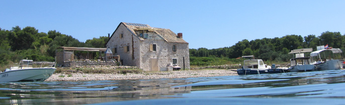
UNIJE (44° 38’N; 14° 15’E), village (pop. 81 in 1991) and small harbour on the W coast of the island of Unije.
Approach: Shape course for the belfry and chapel on the hill SE of the village and the red round tower with a column and gallery (red light) on the head of the breakwater.
By night approach in the red sector of the light on the breakwa- ter. Skoljic rock is in the red sector of the light on Vnetak point (a round stone tower above the attendant’s house).
Mooring: The harbour is sheltered from the sirocco but exposed to SW and NW winds, which send in a big swell. Larger yachts can anchor SE of Skoljic rock, some 500m from the coast (depth 2025 m); good holding. Yachts drawing up to 3m can moor on the inner side of the breakwater, which is also used by passenger ships.
After the first heralds of W and NW winds leave the cove and go to Podkujna or Vognisca cove on the N coast of the island.
Facilities: Post office, medical service, several restaurants and a shop. Limited provisions and water.
Coastal passenger lines: Mali Losinj Srakane Vele Unije Ilovik Susak Mali Losinj; Rijeka Mali Losinj (see also Mali Losinj and Rijeka).
VRULJE (44° 37’N; 44° 15’E), cove on the E coast of the island. It is well protected from the bora; small yachts anchor along the coast E from the Vnetak point.
MARACOL (44° 38,6’N; 14° 15,4’E), cove on the E side of the island of Unije.
Mooring: It is well protected from all winds, except the sirocco. Small yachts can moor at the head of the pier or in four-point berths (there are bollards on the mole). Anchorage lies SE from the pier (depth 79 m).
ISLAND OF SUSAK
DRAGOCA (44° 31’N; 14° 18’E), cove in the NE part of the island, the small harbour of the village of Susak (pop. 188 in 1991).
Approach: Landmarks: the Susak lighthouse, the belfry in the vil- lage, the factory chimney in the W part of the cove and the round green tower with a column and gallery (green light) on the break- water. Dragoca is accessible only to smaller yachts (depth 2.5 m). When entering the harbour keep to the middle of the fairway, between the light on the head of the breakwater and the red round buoy marking the E edge of the remains of the old breakwater.
Mooring: The cove is protected from S and W wind; NE wind causes an unpleasant sea, while SE wind whips up a strong chop. Moor on both sides of the pier or along the masonry breakwater. With NE wind and the sirocco leave the moor at the head of the breakwa- ter. Four-point anchoring in the SW part of the cove only offers full safety.
Facilities: Harbour master’s branch office, post office, shop and medical service. Limited provisions and water (drinking water should be boiled). Fuel and other shopping in Mali Losinj.
Coastal passenger lines: see Mali Losinj and Rijeka.
Sights: Sv Nikola biskup church (St Nicholas the Bishop, 1770), next to it the ruins of the Benedictine monastery (11 C).
The island is interesting from the ethnographic point of view. The islanders live in isolation (endogamy) and their dialect, customs and costume differ from those found on the neighbouring islands.
PORAT (44° 31’N; 14° 17’E), cove on the NW coast of Susak.
Mooring: The cove is sheltered from the bora; it is exposed to SW and NW winds and a longer stay is not advisable even in the sum- mer (maestral).
Larger yachts can anchor some 300m off the W coast of the island (depth 3040 m), in line with the lighthouse (elevation 100 m, white flashes, visibility 23 M) on Mt Garba, bearing 210°.
ISLAND OF ILOVIK
ILOVIK (44° 28’N; 14° 33’E), village (pop. 145 in 1991) and small harbour on the NW coast of the island of Ilovik. The middle fair- way between the islands of Ilovik and Sv Petar (bearing NWSE) is navigable for yachts drawing up to 6 m.
Approach: Landmarks: shape course for the white tower with a column and gallery (white light) on the islet of Sv Petar and the belfry of the church in Ilovik.
Mooring: The harbour is sheltered from all winds; a strong sirocco sends in an unpleasant sea. The best anchorage for smaller yachts is in the middle of the fairway, S of the small church on Sv Petar (depths 710 m), stern-to NE; several bollards. Moor along the head of the pier (60m long, depth 3.5 m) off the village; smaller yachts can moor along the pier in the E part of the harbour.
Facilities: Post office. Limited provisions and water.
Coastal passenger lines: IlovikPremudaSilbaOlibZadar, IlovikMali Losinj (see also Mali Losinj and Zadar).
Sights: The ruins of a large prehistoric fortification at Straza. On the islet of Sv Petar are the ruins of a Roman villa rustica and of the walls of the Benedictine monastery St Petrus in Nembis (11 C); also a defence tower, built in 1597 against the Uskoks.
ISLAND OF KRK
SOLINE (45° 09’N; 14° 38’E), bay on the NE coast of the island; the largest village and harbour is Klimno (pop. 100 in 1991), situated on the S coast of the bay. The bay is sheltered from all winds and affords a safe anchorage for smaller yachts.
Approach: Landmarks: the stone tower with a red top (red light) on Glavati point; the round red tower with a column (red light) above the white base on Crni rock (some 0.3 M off the harbour), and the red column (red light) on the head of the breakwater of the harbour of Klimno. When entering the bay keep as near as the SE coast to avoid Solinji reef. Care must also be taken of Crni rock (light), V. Skoljic rock and of the shoal (1.8 m) E of this rock.
Mooring: Yachts drawing up to 2m can moor on the inner side of the breakwater of the harbour of Klimno or along the mole of the village of Cizici on the W side. The NE part of the bay affords good anchorage in 56 m and W of the harbour of Klimno (the anchorage of the Punat marina). The cove and the harbour of Klimno are well protected from all winds.
Facilities: Provisions in a local shop, limited water. Repairs and dockage over the winter at the local yachtyard and at Punat marina (its own facilities).
There is an oyster farm in the bay.
STIPANJA (45° 09’N; 14° 40’E), cove and anchorage on the E coast of Krk. The small harbour and village of Silo (pop. 346 in 1991) is situated at the head of the cove.
Approach: The white octagonal tower (white light) at the root of Silo point and the green tower with a column and gallery (green light) at the head of the breakwater in the small harbour of Silo are conspicuous. Entering the cove take care of the shoal off Silo point; when mooring take care of the protruding underwater part of the breakwater.
Mooring: The cove is well sheltered from all winds. Smaller yachts can moor along the inner side of the breakwater of the harbour of Silo (depth 2.5 m) or along the quay (four-point moor); a part of the breakwater is reserved for car-ferries. There is a good anchorage S of the light on Silo point and in front of the small harbour of Silo; care must be taken of the underwater cable.
Facilities: In the harbour of Silo: harbour master’s branch office, post office, tourist office (accommodation in private houses), shops and restaurants. Provisions in a local shop; fuel in Crikvenica.
Repairs on smaller yachts and yachts and marine engines, off- season dockage and maintenance services.
Sights: Dobrinj with the church of Sv Stjepan Prvomucenik (St Stephen the Martyr, built in 1100, renovated in 1903, the embroidered antependium depicting the Coronation of the Virgin, 15 C) and the Ethnographic Museum 5 km by road.
VRBNIK (45° 05’N; 14° 41’E), village (pop. 950 in 1991) and small harbour on the E coast of Krk in Vinodolski kanal.
Approach: The houses and the church belfry on the hill (49 m) and the red tower with a column and gallery (red light) on the head of the breakwater can be identified.
Mooring: The harbour is sheltered from all winds, but the entrance to the harbour is exposed to the bora, which makes approach difficult and dangerous with the bora blowing. Smaller yachts can moor on the inner side of the breakwater (depth 2 m) and along the head of the mole (depths up to 4 m). The inner part of the harbour is occupied by fishing yachts.
Facilities: Post office, shops, hotel, medical service. Provi- sions and other shopping in local shops; mains water supply.
Sights: The remnants of the medieval town wall with towers, Uznesenje Marijino church (the Assumption, 15/16 C, renovated in 1966), Sv Ivan church (St John, 15 C, at cemetery), Dinko Vitezic’s Library (15,000 volumes, illuminated manuscripts, incunabulae).
BASKA (44° 58’N; 14° 46’E), village (pop. 816 in 1991), tourist resort and small harbour in the N part of Bascanska draga.
Approach: Landmarks: the coast lights in Senjska vrata: the white tower with a gallery (white light) in front of the house on Strazica point (Prvic Island); the red tower (red light) on Skuljica point (Krk Island); the ruins on Kricin point (E of the harbour); the belfry in the town; the quadrangular tower with a green top (green light) on the head of the breakwater; the red tower with a column and gallery (red light) on the head of the pier.
Mooring: Smaller yachts can moor along the waterfront; the root of the breakwater is reserved for passenger ships and a car- ferry. Larger yachts can anchor some 400m off the breakwater bearing SW (depths 2030 m); good holding. The inner harbour (depths 1.53 m) is sheltered from all winds; the anchorage is exposed to the bora and SE winds and is not recommended for a longer stay.
NE of Baska there are Vela luka and Mala luka coves, and SE there is Bracol cove. In Vela luka there is a landing ground (30 m long, 2 m deep); it is well protected from the sirocco and from the bora; during the stormy bora it is recommended to use a four-point moor along the E coast. In Mala luka there is a natural coast, but it is a safe shelter from all winds. In Bracol cove there is a landing ground for small yachts; it is well pro- tected from all winds.
Facilities: Harbour master’s branch office, post office, several shops, hotels, restaurants, travel agency, bank, camp site, medi- cal service, chemist’s. Skrpina Fishing Club and Vihor Sailing Club.
Water from a hydrant, provisions in the village. The harbour has two small slipways and a crane (0.8 t).
Car-ferry line: BaskaSenj and BaskaLopar (Island of Rab).
Sights: Remains and excavations of the Roman settlement and for- tifications; the churches of Sv Ivan (St John, early Romanesque), Sv Trojica (Holy Trinity, 1723), and Sv Marko (St Mark, Romanesque); Town Museum (ethnographic and maritime collections). Jurandvor: a former Benedictine monastery with Sv Lucija church (St Lucia), about 1100, the original site of the Bascanska ploca, the oldest Glagolitic inscription (on a stone tablet, dating back to ca. 1100) 2 km by road. Further on there is Bascanska draga village and a pheasant farm 4.5 km by road.
Baska is the venue of two traditional events taking place in August: Fishermen’s Day (Dan ribara) and the Traditional Baska Wedding (Bascanski starinski pir).
STARA BASKA (44 57,5’N; 14 41E), cove and small harbour on the SW coast of the island of Krk.
Approach: Landmarks: the village and a church.
Mooring: At the head of a small landing ground (depth 2.53.7 m); four-point moor, anchoring towards NE and with a stern at the pier or the mainland. Good anchorage at the Klobucac point (not safe during SW and W winds). The cove is a good shelter from the bora; the harbour is protected from the sirocco.
PUNAT (45° 01’N; 14° 37’E), town (pop. 1,696 in 1991) and harbour in the large but shallow cove of Puntarska draga in the NE part of the Krk Bay. A popular seaside resort.
Approach: Landmarks: the white tower with a column and gallery (white light) in front of the small chapel at the E entrance point of Pod Strazicu; three round green towers (green lights) on concrete bases in the sea and three conical stone marks; the green tower with a column and gallery (green light) on the mole.
When entering, pass between the conical stone marks and the green lights, leaving the lights to the starboard (E) at least 10 m. When entering by day, turn to the harbour of Punat after passing the N green mark (light) by about 70 m, and by night when you see the green harbour light on the mole. Maximum speed 4 knots.
Mooring: The harbour is well sheltered from all winds. Smaller yachts can moor along the quay in the harbour or anchor off the town and N of the islet of Kosljun (a safe anchorage in stormy winds from NW); care should be taken of an underwater cable.
Facilities: Harbour master’s branch office, post office, several hotels and restaurants, camp site, shops and medical service, chemist’s. Good shopping for provisions; water from the hydrant on the quay. Arbun Fishing Club and Vihor Sailing Club.
Repairs carried out in the Punat Yachtyard and in the marina.
Sights: Sv Trojica church (Holy Trinity, 1773, renovated in 1934). The old olive mill (stari tos, 18 C). The islet of Kosljun: the Franciscan monastery (formerly an early Romanesque Benedictine monastery, the cloister, defense tower, St Bernardine’s chapel); Navjestenje Marijino church (Annunciation, 1523, fine collection of sacral art); a collection of stone monu- ments, ethnographic collection and old library with rare items.
PUNAT MARINA is situated on the E coast of Puntarska draga cove, N of the town of Punat, adjoining the Punat yachtyard.
Capacity: 800 moorings for yachts up to 25m are laid out along the quay and the 11 jetties (four-point moor, depth 3.5 m); there are dry-berths for 300 yachts.
The marina is open the year round.
It has reception office, money-exchange, self-service shop, shop and duty-free shop, ship chandler’s shop, snack-bar, two restau- rants and an inn; skipper’s club (restaurant, yacht club, medical service, sailing school); a parking lot for 500 cars. The chemist’s is in the town; toilets and showers with hot water.
Tourist office is 200 m away. Custom-house is at the airport (30 km). A camp site for motorists is nearby; nudist camp (5 km). Fuel available in Krk.
Sport and recreation: fishing and underwater fishing outside Pun- tarska draga; tennis court, miniature golf. Yacht rental (charter fleet): yachts of various types up to 5 m in length, yachts (sail- ing yachts and motor yachts) up to 20 m in length.
Hoists (5 and 10 t), slipway (for yachts up to 30 and 50 tons), several travel-lifts; services (security, cleaning, etc.) pro- vided; yacht services; hull repairs (wood, plastic, metal); regu- lar hull inspection; repair, maintenance and installation of marine engines (VOLVO, JOHNSON, MERCURY, YANMAR, CUMMINS), electrical installations and battery charging; special varnishing shop.
KRK (45° 10.6’N; 14° 34.5’E), town (pop. 3,022 in 1991) and har- bour in the NW part of Krcki zaljev (Krk Bay).
Approach: Landmarks: the church with the belfry surmounted by a statue; the quadrangular red brick tower (red light) on the head of the breakwater; the round white tower with a column (green light) on the head of the E breakwater.
Mooring: The harbour is open to the sirocco and partly protected from the bora (EENE); it offers very good shelter in all other winds. The safest mooring during the sirocco (waves splash over the breakwater) for larger yachts is on the inner side of the E mole (depth 3.54.0 m), which is otherwise reserved for ships of the coastal passengers lines, and for smaller yachts deeper in the harbour. The best mooring during the bora is along the quay between the two moles (four-point moor). The breakwater is not accessible because of shoals and scattered stones.
Facilities: Harbour master’s branch office, post office, medical service, chemist’s, museum, travel agency, several hotels, camp site, shops, shipyard. Lovrata Fishing Club and Plav Sailing and Rowing Club.
Water from the hydrant at the entrance mole; fuel in the harbour at the small mole and in the W part of the harbour.
The Riba shipyard carries out general repairs including diesel engine repairs; hauling-out service.
Car-ferry lines: ValbiskaMerag; BaskaLopar (Island of Rab).
Sights: Uznesenje Marijino Cathedral (The Assumption of Our Lady, 12 C, built on the site of the Roman thermae /1 C/ which was suc- ceeded by an early Christian basilica /5/6 C/; an art collection with items ranging from Classical times to the Baroque; Gothic chapel of the Frankopan family), the Bishop’s Palace with an art collection, the two-storey basilica of Sv Kirin (St Quirinus, Romanesque, fragments of wall paintings), the churches of Gospa od Zdravlja (Our Lady of Salvation, Early Romanesque, 12 C), and Sv Franjo (St Francis, 1290); the Canon’s House (11 C); Kotter House with Romanesque windows, well-preserved town walls (from 11 C onwards) with Kamplin Tower (1191), fort, bastions (15/16 C) and a round tower; Roman cemetery.
VALBISKA (45° 01’N; 14° 30’E), cove on the NW coast of Krk Island, 3.4 M west of the harbour of Krk. The hillsides precipi- tate steeply into the bay.
Approach: Landmarks: the white tower with a column and gallery (green light) on Sv Mikula point, the surfaced road at the root of the cove and the red tower with a column and gallery (red light) on the head of the ferry pier.
Mooring: The cove is exposed to SW winds but is sheltered from NE and SE winds. The bora is violent and blows in gusts.
Car-ferry line: ValbiskaMerag (island of Cres).
TORKUL (45° 02.6’N; 14° 28.2’E), cove in Srednja vrata on the SW coast of Krk, some 2.5 M southeast of the coast light on Manganel point.
Approach: Landmark: the ruins of the tall narrow building at the N entrance point.
Mooring: The cove is sheltered form all winds and affords a good berth to yachts drawing up to 1.3 m. With the bora blowing, go stern-to the waterfront, bows-to NE.
On the E coast of the cove is the house of the Lubin Fishing Club of Rijeka.
CAVLENA (45° 06’N; 14° 28’E), cove 4 M south of Malinska at the entrance to Srednja vrata straits, sheltered from the bora and easterlies. The anchorage is safe for yachts of all sizes in depth of up to 40 m. Smaller yachts can anchor off the E coast.
MALINSKA (45° 08’N; 14° 32’E), village (pop. 999 in 1991) and seaside resort on the W coast of Krk.
Approach: Landmarks: the green spar surmounted by a cone marking the shoal on the SW side of the entrance should be left to star- board; the red tower with a column and gallery (red light) on the head of the mole; the white tower with a column and gallery (red light) in front of the Haludovo hotel complex.
Mooring: The harbour is exposed to NW winds, which cause a swell in it; in the summer they are usually shortlasting storms. Smaller yachts can moor on both sides of the pier and along the mole in the S part of the harbour and the quay E of the pier (depth 2 m). About 300m NW of the pier is a 100m long breakwater under construction. The end of the breakwater is marked by a red buoy. The best anchorage is about 0.5 M west-southwest of the harbour (depths 2545 m).
Facilities: Harbour master’s branch office, post office, several hotels and restaurants, shops, tourist office, medical service, chemist’s.
Lastavica Fishing Club and Dub Sailing Club.
Water from the hydrant on the E waterfront; fuel in the harbour.
In the immediate vicinity of the harbour is the Haludovo hotel complex with a small harbour for smaller yachts (a hoist and slipways). It is used mainly by hotel guests.
There is a slipway and a hoist for smaller yachts. The yachtyard makes and repairs the wood panelling on smaller yachts and speed- yachts.
Sights in the neighbouring villages. Porat the Franciscan monastery (15 C) with Sv Marija Magdalena church. Dubasnica the belfry of a dilapidated church (1618). Bogovici the chapel of Majka Bozja Karmelska (Our Lady of Carmel, 1644). Zgombici Sv Andrija church (St Andrew, 15 C). Strilcici the ruins of Sv Nikola church (St Nicholas, Gothic).
BELI KAMIK (45° 10’N; 14° 32’E), anchorage some 3 M north of Malinska; the village of Njivice (pop. 1,169 in 1991).
Approach: Shape course for the green round tower with a column and gallery (green light) on the head of the pier in Njivice and the hotel buildings there.
Mooring: The anchorage is sheltered from the bora and the sirocco, but is open to SW and NW winds. Larger yachts can anchor N and W of Njivice in 3040 m. With the bora and the sirocco blow- ing, a safe anchorage for smaller yachts is in the harbour of Kijac, S of Beli Kamik anchorage; in fine weather yachts can moor along the inner side of the breakwater in Njivice.
Facilities: Post office, hotels and other facilities in Njivice.
Provisions in local shops; water from the hydrant on the water- front.
OMISALJ (45° 13’N; 14° 33’E), town (pop. 1,554 in 1991) and small harbour on the N coast of Krk Island, in the bay of Omisalj.
Warning: On the W coast of the bay is the oil unloading terminal; yachts are not allowed to come nearer than 500 m to the coast. The sea area around Sapan cove is the industrial zone of the har- bour of the INA petroleum company.
Approach: From W landmarks: the large white oil containers on Tenka peninsula; some 1.5 M northwest of Kijac point is the light buoy with red and white stripes (white light); the round red tower (red light) on Kijac point; several light buoys mark the fairway for tankers and a landing-light in Omisalj marks the approach course 151°; the white tower with the column and gallery (red light) on the head of the pier; the hotel near the pier and the water-supply tower.
Mooring: Only smaller yachts (draught up to 3 m) can moor along the pier in the harbour and the moles in the small harbour SE of the pier. In front of the Jadran hotel there is a pier (50 m, depth 3.5 m).
Facilities: Harbour master’s branch office, post office, medical service, shops. Zubatac Fishing Club and Juna Sailing Club.
Provisions, water from the main. Fuel at the pump some 2 km from the waterfront.
Off-season dockage f
Facilities: Minor repairs to wooden yachts and speedyachts can be undertaken. Crane (5 t).
Omisalj is the venue of the Stomarina Festival (August 15), the day of all seagoing yachts.
Sights: The town has a Gothic street lay-out. The churches of Marijino Uznesenje (Assumption of Our Lady, built before 1405, later additions, three-nave Romanesque basilica), Sv Jelena (St Helena, 1470), Sv Antun (St Anthony, Romanesque) and Sv Ivan (St John, 1442); the ruins of the Rector’s palace (14/15 C), the Log- gia (1470), Pancirov House (Gothic). In Sepen cove the ruins of Fulfinium (Roman, 13 C) with a basilica (6 C).
ISLAND OF RAB
RAB (44° 45’N; 14° 46’E), town and harbour (pop. 592 in 1991) on the island of the same name.
Approach: Landmarks: the town walls and four belfries; the round green tower with a gallery (green light) on a concrete base on Frkanj shoal; the quadrangular stone tower with a red top (red light) on Frkanj point; the round red tower on Sv Ante point (red light) and the multi-storey tower with a green topmark on the islet of Tunera (green light); the white tower with a column and gallery (white light) on Donji point (the islet of Dolin).
Warning: Off the entrance to the outer part of the harbour are two shoals: Vela sika (3.8 m) and Frkanj. Do not exceed 3 knots when entering or leaving the harbour.
Mooring: The inner harbour is sheltered from all winds except the south-easterlies. The sirocco causes a strong swell in the har- bour with waves flooding part of the W waterfront. It is there- fore recommended for yachts to go to the Rab marina. The best anchorage for larger yachts is in the nearby Sveta Fumija cove (depth 428 m) and NW of Tunera islet at the entrance to the har- bour.
Facilities: Harbour master’s branch office, post office, several hotels and restaurants, various shops, medical service and chemist’s. There is a naturist hotel complex on Frkanj peninsula. Kanjac Fishing Club.
Provisions are available in shops. Water from a hydrant, fuel from the pump in the Rab marina.
Several yachtyards at Banjol make and repair yachts, speedyachts and small wooden and plastic yachts. The mechanics at Banjol carry out repairs of outboard engines (JOHNSON, CHRYSLER, EVINRUDE, VOLVOPENTA, SAAB).
Car-ferry lines: LoparBaska (Island of Krk) and MisnjakJablanac (mainland).
Sights: The town wall (12/13 C, later reinforced, pulled down in part at the beginning of 20 C), with the Town Tower; Rector’s Palace (13 C, later reconstructions), the Loggia (1509), Sv Marija Velika cathedral (St Mary the Great, 1177, renovated in 1278 and 1483, ciborium about 1500, choir stalls 1455, with the parish art collection, the belfry from 1181); the ruins of Sv Ivan church (St John, 10/11 C, with the belfry from 12 C); the churches of Sv Andrija (St Andrew, Romanesque, reconstructed in the Renaissance) and Sv Justina (15731578); the residences of the families Crnota (15 C), Cassio (Gothic), Dominis-Nimira (15/16 C), Nimira (16 C, with a portal), Tudorin, Kukulic and Marcic- Galzigna. Komrcar Park, landscaped at the end of 19 C, with Sv Franjo church (St Francis, 1490). In Trg Slobode square stands the Tree of Freedom (Stablo slobode) a natural memorial. In the NW part of the island is Dundo Wood a nature reserve.
RAB MARINA (ACY) is situated on the E side of the inner harbour, directly behind the breakwater, in the SE part of the harbour. It is sheltered from all winds except the southerlies by the break- water; SE winds cause a strong slop (especially dangerous in the winter) and raises the sea level by up to 1 m; it can break the securing ropes of yachts and floating fingers.
The marina has 150 berths for yachts drawing up to 5m and up to 15m in length; there are dry-berths only for yachts that are being repaired or overhauled. Water and electricity hook-ups at the berths. The marina has a meteorological service (warning and alarm sounding, weather reports and other relevant information).
The marina is open the year round.
It has reception office, restaurant, shop, duty-free shop, recreation ground, toilets and showers with hot water, parking lot, fuel and gas pump. Hoist (5 t); slipway; repairs.
SVETA MARA (44° 47’N; 14° 40’E), cove some 0.7 M east-southeast of Donja punta point (white coast light) on the SW coast of Rab.
Approach: Landmarks: the small white house on the hill above the ruins of the chapel on the E coast of the cove. The round white tower (white light) on Donja punta point.
Mooring: The cove affords good shelter for smaller yachts from the bora and the sirocco. Smaller yachts can anchor in the middle of the cove, securing stern to the bollards cut out in the rock.
KAMPORSKA DRAGA (44° 47’N; 14° 42’E), cove E of Kalifront point on the NW coast of island of Rab.
Approach: Maman islet, which separates the cove from the neigh- bouring Supetarska draga, can be easily identified.
Mooring: Because of the shoals fringing the NE and SW coast of the cove and off the islet of Maman, Kamporska draga does not afford good anchorage. It is exposed to the north-westerlies which cause a considerable sea; the bora and the sirocco are strong but do not create a sea. Smaller yachts can anchor S of Kastelina point securing stern to the bollards on the coast.
Facilities: Supermarket in the W part of the village of Ruzici (pop. 1,102 in 1981).
Sights: Sv Eufemija church (1237) with the Franciscan monastery (1446, library, historical collection, collection of stone monu- ments) and Sv Bernardin church (1458, later reconstructed in the Baroque style). Nearby the ruins there is a Roman villa rustica. Memorial cemetery, built in 195055 on the site of a former Nazi concentration camp (194243).
SUPETARSKA DRAGA (44° 48.5’N; 14° 42.5’E), town (pop. 1,114 in 1991), cove and marina in the NW part of Rab, some 2.5 M southeast of Sorinj point.
Approach: Care should be taken of the reef some 50m N of the islet of Sridnjak, SW of the entrance to the cove. The reef is visible only at low tide and a choppy sea; it is marked by a con- crete column.
Mooring: The cove is exposed to N and NW winds, the bora and the sirocco are violent in it but do not cause a sea and are not dangerous for yachts lying at anchor. The best anchorage for smaller yachts (sheltered from NW winds) is in the middle of Dumici cove (S of the islet of Sajlovac). Larger yachts can anchor in the middle of Supetarska draga (depths 2128 m).
Sights: The disused Benedictine monastery of St Peter, esta- blished in 1059, abandoned in 16 C. Sv Petar church dating from the foundation period.
SUPETARSKA DRAGA MARINA (ACY Grassetto) is situated on the NE coast of the cove of the same name.
The following landmarks are conspicuous: the white towers (white light) on Kalifront point and Kristofor point; the red tower with a column and gallery (red light) on the head of the breakwater in the marina; the low buildings of the workshops and the main office of the marina. The marina is situated at the edge of a wood and olive groves.
It is protected from NW winds by a 160m long breakwater.
Capacity: 280 berths along the breakwater and the floating fingers for yachts up to 15m long. There are 150 dry-berths. Water, electricity and telephone hook-ups at the berths. The shallow water along the waterfront, built at an incline from piled up rocks, increases rapidly in depth to 1025m in the middle of the cove.
The marina is open the year round.
The meteorological service in the marina provides regular weather reports (bulletins and information).
It has reception office, restaurant (tavern), shop, duty-free shop, toilets and showers with hot water; laundry; car park; ren- tal of sports equipment; water, electricity and telephone hook- ups. Ample opportunity for water sports.
Fuel at the pump in the Rab marina. Other shopping in the shops in the marina and in the town of Rab.
Hoist (10 t) and a slipway; general repairs. Major repairs in Punat shipyard (Island of Krk).
LOPAR (44° 50’N; 15° 43’E), town (pop. 1,215 in 1991) and small bay on the N coast of the island of Rab.
Approach: Shape course for the white tower (white light) on Sorinj point; the belfry of Sv Marija church on the hill above the town; the yellow building next to the pier; the green tower with a column and gallery (green light) on the head of the pier.
Care should be taken of the shoals of Pregiba and Vela sika (cylindrical yellow-black-yellow buoy, 2 cones point to point) in the N part of the bay, W of Stojan point.
The bay is open to NW winds, which cause a sea. The bora and the sirocco are strong.
Mooring: Smaller yachts moor at the head and the S side of the pier in front of the hotel (alongside them or by using the four- point moor); the N and outer sides of the pier are reserved for the ferry. The anchorage for smaller yachts, safe only with the bora, is in Makucina cove in the SW part of Loparski zaljev (Bay of Lopar).
In the San Marino tourist village on the NE side of Lopar there is a small harbour for yachts up to 10 m.
Facilities: Post office and medical service. Provisions and water (from cisterns) available.
Car-ferry line: LoparSenj and LoparBaska.
Sights: Ruins of walls dating back to the ancient times.
ISLAND OF PAG
STARA NOVALJA (44° 36’N; 14° 52’E), village (pop. 234 in 1991) in the small bay of the same name on the NE coast of the island of Pag.
Approach: Landmarks: the quadrangular white tower on a base (white light) on the N entrance of Deda point, the hill of Veli vrh (131 m) opposite Deda point and the buildings on the NE coast of the bay.
Mooring: The bay is sheltered from the bora and the sirocco. The sea in it is not dangerous. Yachts drawing up to 3.5m can moor on the end side of the L-shaped mole just off the village. The best anchorage for larger yachts is S of Drljanda cove, NW of Stara Novalja (depth 2738 m). A good anchorage for smaller yachts is in the NW part of Drljanda cove, E of the entrance to the cove. It is a good shelter from the bora and the sirocco. With the bora blowing, anchor bows-to SW and secure to the coast bearing NE. The mole in Drljanda cove is reserved for the car- ferry. Car-ferry line: Stara Novalja (only during the storm) Prizna (mainland).
Sights: Ruins of walls dating from ancient times, a necropolis dating from the late Roman period, ruins of the Pre-Romanesque church of Sv Kriz (Holy Cross).
PAG (44° 27’N; 15° 03’E), town (pop. 2,421 in 1991) and harbour on the SE coast of Paski zaljev (Bay of Pag).
Paski zaljev is entered through Paska vrata passage (between Kristofor and Sv Nikola points). There are several coves in the bay: Slana, Rucica, Metajna, Caska and the harbour of Pag.
The bora in the bay is strong and most frequent in Paska vrata passage and Slana cove; in the NW part of the bay it blows from the E and in SE part from the N. With a strong bora blowing, spindrift and a turbulent sea make it difficult to enter the bay. With the sirocco blowing the sea sometimes floods the coast around the salt-works. Currents caused by the tides attain a rate of 4 knots; their direction is changeable.
Approach: Landmarks: the white tower (white light) on Kristofor point; the red tower (red light) on Sv Nikola point. In the bay: the green tower with a column and gallery (green light) on Zaglav point; the belfry of the church in the town, the large salt storehouse at the head of the harbour and the hotel buildings on the SW coast, the red tower with a column and gallery (red light) on the head of the mole reserved for the car- ferry, the red tower with a column and gallery (red light) on the head of the S pier.
The harbour is entered through a 50m wide and 4.5m deep fairway. The axis of the fairway is indicated by the two iron structures (one front, the other back) of the former harbour light with a black triangle with a white vertical line on the top of the each structure. The starboard side of the fairway is marked by two conical green buoys and, further toward the bridge, by two green spars surmounted by a cone. The port side of the entrance is marked by the round red tower with a column (red light) on the head of the ferry pier and the red tower with a column and gal- lery (red light) on the head of the S pier. When entering, leave the red light on the ferry pier to port, giving it an offing of 1520 m, and shape course for the light on the head of the S pier. Care should be taken of the current caused by the changing tide (up to 4 knots).
Mooring: The harbour is protected from all winds except the westerlies, which blow infrequently. Yachts drawing up to 3.5m can moor (four-point moor) on the inner end of the small N mole in the inner harbour or along the quay next to the bridge. The best anchorage for larger yachts is off the E coast, some 1.5 M south of the ruins of the chapel of Sv Nikola (depths 2448 m). In fine weather smaller yachts can anchor off the ruins of the chapel of Sv Katarina.
Facilities: Harbour master’s branch office, post office, several hotels and restaurants, medical and veterinary service, bank, chemist’s. Orada Fishing Club.
Good shopping for provisions. Water from the hydrant on the waterfront. Fuel at the petrol station in Pag.
Hoist (1 t) and a slipway in the harbour.
The local dairy makes the excellent Pag sheep-milk cheese (paski sir); the well-known Zutica wine is also made locally. The Basaca camp organizes a traditional summer carnival (July 2629). The Lokunja thermal spa (radio-active mud used in treating rheumatic diseases) is situated on the SW coast of the bay, opposite the town.
Car-ferry lines: ZigljenPrizna (mainland) and PagKarlobag (main- land).
Sights: The development of the town began in 1433 and was planned by the builder and sculptor Juraj Dalmatinac. Parts of the town wall with the clock tower (after 1433), the Rector’s Palace (1467, unfinished), Uzasasce Marijino cathedral (Assumption of Our Lady, 1443-88), the churches of Sv Juraj (St George, Renais- sance) and Sv Margareta (second half of 15 C). Stari Grad (the centre of the island before the development of the present-day town; 14 C church, next to it the ruins of the Franciscan monastery) 3 km SE. Climb to the summits of Sv Vid (348 m) and Sv Juraj (263 m) panoramic view of the area.
Pag has an eight-century-old tradition of lace-making; the lace- making school was established in 1906.
CASKA (44° 33’N; 14° 56’E), cove and village in the NW part of Paski zaljev (Bay of Pag). A very good anchorage sheltered from the bora. The best anchorage for larger yachts is in Zrce cove, some 0.5 M southeast of the village of Caska (depth 17 m). Smaller yachts can anchor closer to the innermost part of the cove, off the village.
Facilities: Limited provisions.
Sights: On the site of the Roman military camp Cissa: remnants of buildings, of a road and aqueduct, the ruins of the acropolis; Sv Juraj church (St George, early medieval).
METAJNA (44° 31’N; 15° 05’E), village (pop. 272 in 1991) and cove in Paski zaljev (Bay of Pag).
Approach: Landmarks: Mt Zaglava (117 m), the green tower with a column and gallery (green light) on Zaglava point, the church with the belfry in the S part of the cove and the ferry pier can be easily identified.
Mooring: The cove is well sheltered from the bora and the sirocco. Good anchorage for larger yachts is some 0.5 M west- northwest of the chapel of Sv Marija at the S edge of the vil- lage; yachts drawing up to 2m can anchor closer inshore.
Facilities: Limited provisions and water available.
DINJISKA (44° 22’N; 15° 10’E), village (pop. 181 in 1991) and cove on the SE coast of the island, NE of Ljubacka vrata passage.
Mooring: The cove is a reasonable shelter from the bora; the sirocco is strong in it. Larger yachts can anchor along the NE coast and smaller ones in the cove (depth 13 m). Care should be taken of the rocks on both sides of the entrance to the cove. Yachts can also moor along the pier SE of the village of Miskovici.
STARA POVLJANA (44° 19’N; 15° 10’E), uninhabited cove in the SE part of the island of Pag. Sheltered from the bora, it is open to the sirocco, which blows with great force but without causing waves. Larger yachts can anchor at Skamica (depth up to 36 m); smaller yachts can anchor in Gradac cove, SE of the village of Smokvica.
NOVA POVLJANA (44° 21’N; 15° 06’E), village (pop. 678 in 1991) and cove on the SW coast of the island of Pag.
Approach: Landmarks: the red round iron tower with a column and gallery (red light) on Dubrovnik point, the hotel complex and the chapel of Sv Nikola on the E coast of the cove.
Mooring: The harbour is well sheltered from the most frequent winds, the bora and sirocco, but is open to winds from the SW and NW quadrants. Yachts drawing up to 3m can moor on the inner side of the breakwater. With the bora and sirocco blowing, larger yachts can anchor only in the middle of the cove and smaller ones closer to the chapel of Sv Nikola.
Facilities: Provisions and water in the village of Povljana, 0.8 km inshore.
Sights: Sv Nikola (early medieval, fragments of frescoes) and Sv Juraj (18 C) churches.
KOSLJUN (44° 22.8’N; 15° 05’E), village (pop. 38 in 1991) and small harbour in Kosljunski zaljev (Bay of Kosljun), on the SW coast of the island, between Tihovac and Zminka points.
Approach: Landmarks: the quadrangular white iron tower with the white light on Zaglav point and the white round tower with a gal- lery (sector light) at the head of the breakwater.
Zminka and Tihovac points are fringed by shoals; by night the green sector of the light at the root of the breakwater indicates the safe passage. Mooring: The bay is sheltered only from winds from the NE qua- drant (it is therefore the auxiliary harbour of the town of Pag in the bora); southern winds cause a heavy sea in the harbour. Smaller yachts can moor along the head of the breakwater (depth about 2 m), or use the four-point moor on the rest of the break- water (depth under 1 m). Larger yachts can anchor WSW of the ruins on the NE coast, some 700m offshore (depth 1823 m). The harbour is not recommended for a longer stay, especially in bad weather.
Facilities: Limited provisions and water are available.
SIMUNI (44° 28’N; 14° 57’E), village and small bay on the W coast of the island of Pag in Maunski kanal.
Approach: Conspicuous landmark is the round white tower (green light) on Simuni point. On the port side of the bay there are submerged rocks and Simuni shoal (depth 1.3 m) and while entering the bay steer clear of the points on the left side of the bay.
Mooring: The bay is well sheltered from all winds. During the bora, small yachts can anchor in the SE part (depth up to 1.5 m); good anchorage. Yachts drawing up to 2 m can moor (four-point) along the mole in the NE part.
Limited provisions and water.
SIMUNI MARINA is located in the cove on the NW side of the Simuni bay (Maunski kanal), W part of the island.
The marina has 150 sea-berths and area for 30 yachts (dry- berths); water, electricity, telephone and satellite TV hook-ups. Slipway (for yachts up to 8 m long); crane (15 t).
It has reception office, duty-free shop, restaurant, laundry, toilets and grocer’s shop (groceries can be delivered on the yacht if ordered so). The marina is open the year round.
MANDRE (44° 29’N; 14° 55’E), village (pop. 160 in 1991) and cove on the W coast of the island of Pag in Maunski kanal.
A good shelter for smaller yachts, which can moor off the mole in front of the hotel. The harbour is sheltered from all winds, except those from the SW quadrant. The depth in the harbour is up to 2 m.
Facilities: Provisions at a shop; water from the main.
NOVALJA (44° 33’N; 14° 53’E), town (pop. 1,912 in 1991) and har- bour in the small bay of the same name on the NW coast of the island of Pag. Approach: Landmarks: the belfry and the tall white pole of the HPT relay; the red tower with the column and gallery (sector light) on the S end of the pier. When entering the harbour by night, steer for the green sector of the harbour light on the S end of the mole, which indicates the passage safe from the shal- low reefs.
Mooring: The bay is sheltered from winds from the NE and SE qua- drants; winds from the SW and NW quadrants are very strong.
Yachts drawing up to 2.5m can moor on the inner side of the breakwater and along the pier, which head is reserved for passenger ships; smaller yachts can moor between the pier and the breakwater (four-point moor). A good anchorage for medium- sized yachts is in the middle of the harbour (depths 58 m).
Facilities: Harbour master’s branch office, post office, medical service, a bank, camp site, several hotels and a restaurant.
Shopping for provisions in local shops, water from the hydrant on the waterfront, fuel at the petrol station on the waterfront.
Minor repairs can be undertaken; there are hauling-out facilities for smaller yachts. Engine repairs can also be carried out.
Sights: The ruins of a Roman castrum, a 1 km long tunnel of an underground aqueduct (1 C), fragments of columns; near the town is a site with Illyrian graves, early Christian sarcophagi, the ruins of an early Christian basilica (5 C).
TOVARNELE (44° 41.5’N; 14° 44.1’E), small harbour in the cove of the same name on the NW coast of the island of Pag, some 0.8 M south of Lun point.
Approach: Landmarks: the quadrangular white tower with a column and gallery (white light) on the south entrance point; NW of the cove is the dangerous Tovarnele reef, marked by an iron spar with red and black bands on a round white base surmounted by two black spheres; it is covered by night by the red sector of the light in Tovarnele cove.
Mooring: The cove is sheltered from N winds. Smaller yachts anchor in the middle of the cove (depths 23 m). Anchor bows-to SW, securing the stern to NE. It is also possible to moor offshore, off the restaurant (depth 3 m) or along the L-shaped pier.
Facilities: Provisions and other shopping in the village of Lun; water from the cistern (limited). Smaller repairs in Rab.
Sights: Ruins of ancient walls and of the Romanesque church of Sv Martin.
STARIGRAD (44° 17.7’N; 15° 26.4’E), village (pop. 1,159 in 1991) and small harbour on the NE coast of the southernmost part of Velebitski kanal.
Approach: Landmarks: the round red tower with a column and gal- lery (red light) on the head of the breakwater, the church of Sv Juraj (St George) and the multi-storey Alan hotel.
When approaching from SE, care should be taken of the shoals, reefs and rocks extending some 500m offshore; the S rim of the shoal is marked by a black and yellow buoy surmounted by two black cones points downwards. A shallow reef bank stretches between the buoy and the coast.
Mooring: The harbour is exposed to the bora; the sirocco is moderate but causes waves; the westerlies blow in the summer and are strong and dangerous. Smaller yachts can moor on the E end of the breakwater (depth 2-4 m). In calm weather moor along both sides of the breakwater. The anchorage offshore is exposed to the bora and is not safe.
Warning: Mooring along the damaged E pier is prohibited.
Facilities: Harbour master’s branch office, post office, chemist’s, medical service, a hotel, travel agency, several shops and restaurants, camp site.
Provisions and water in the village, fuel at the petrol station on the Adriatic highway (1km SE).
Sights: Veca kula (a tower dating probably from the time of Turk- ish attacks in 1617 C), Sv Petar church (Pre-Romanesque, 10 C), next to it the ruins of the necropolis with 20 medieval tomb- stones, two pre-historic cairns at the entrance to Velika Paklen- ica. The Velika Paklenica National Park, a karst valley stretch- ing for 10km in the S part of the Velebit mountain range, situated between 450-metre high hills. The cave Manita Pec, the Borisov Dom mountain lodge (550 m), starting point for climbing the peaks of Velebit.
VINJERAC (44° 15.5’N; 15° 28’E), village (pop. 273 in 1991) and small harbour 2.6M west of the entrance to Novsko zdrilo.
Approach: Landmarks: the red tower with a column and gallery (sector white light) on the head of the breakwater, church on the E entrance point. When entering the harbour care should be taken of Stanga shoal, some 0.5M northwest of the harbour, marked by a black and yellow spar surmounted by two black cones points upwards. When approach- ing by night from NW keep within the white sector of the light on the breakwater. Approaching from E, keep off the shallow N of the village; as soon as you sight the red sector of the light on the breakwater, shape course for the light. A number of shoals extend about 800m offshore between Vinjerac and the entrance to Novsko zdrilo; they are marked by a conical green buoy surmounted by a radar reflector.
Mooring: The harbour is sheltered from all winds except the bora, which is very strong and a longer stay in the harbour is not recommended. Smaller yachts moor along the inner side of the breakwater and on both sides of the pier. With the bora and NW winds blowing, moor on the NW end of the pier (four-point moor). When securing, take care of the projecting underwater part of the breakwater.
Facilities: Post office, hotel, tourist office and a shop. Lim- ited provisions and water.
Sights: The ruins of an Illyrian settlement (3/2 C B.C.), Sv Marko church (medieval, part of an ancient Pauline monastery), ruins of a Venetian palazzo of the Venier family hence the name of the village.
RAZANAC (44° 17’N; 15° 21’E), village (pop. 1,039 in 1991) and small harbour, some 5M southeast of Ljubacka vrata.
Approach: Landmarks: the ruins of the tower, the hotel, the church and the red column on the breakwater (red light). The low and bare islets of Razanac veli (white tower with a column, white light), Razanac mali and Donji skolj.
When approaching from SE, care should be taken of the shoals near the outer end of the root of the breakwater.
Mooring: The harbour is protected from all winds except the bora, which is very strong here; a longer stay in the harbour in the bora and the north-westerlies is not recommended. Moor along the breakwater; with the bora blowing, use the four-point moor secur- ing bows-to the breakwater and stern-to the bollards on the oppo- site coast.
Facilities: Post office, medical service, hotel, camp site and tourist office.
Provisions and other shopping in the local shop; water from the main.
Sights: Ruins of an Illyrian fortress and tombs (3/2 C B.C.), Gospa od Ruzarija church (Our Lady of the Rosary, 1682, new church 1856, renovated in 1983); in the vicinity (2 km) Sv Andrija church (St Andrew, medieval); ruins of a defense tower against Turkish attacks (near the harbour, 16 C).
NOVSKO ZDRILO (44° 15’N; 15° 31’E), passage connecting Novigrad- sko more with Velebitski kanal, 2M long, 0.15M wide. The channel is spanned by a bridge (NW of Zdrijac point; destroyed on November 21, 1991 during the Patriotic War).
Approach: Landmarks: at the N entrance to the passage: a green buoy surmounted by a green cone (green light) and a red buoy sur- mounted by a red can (red light); the quadrangular red concrete tower (red light) on the E Baljenica point (conspicuously yellow and brown) and the round red tower with a column and gallery (green light) on Korotanja point at the opposite side of the entrance. The coast of the passage is fringed by several lights; the green tower with a column and gallery (green light) at Vran- ine point and the red tower (red light) at Brzac point. At the Zdrijac point there is a loading place reserved for the car- ferry; on the W side of the south entrance to Zdrilo there is a round green tower with a column and a gallery (green light).
The NW going current in the passage attains a rate of 1 knot, but with the sirocco blowing it can attain 4 knots.
Directions for navigation. The speed limit in the passage is 8 knots. Yachts must not pass or overtake each other in the pas- sage. A yacht about to enter the passage must stop off the entrance, 500m N of the northern point of Baljenica and 500m off the southern point of Zdrijac and give two 5-second siren blasts. Any yacht already in the passage must reply by giving five 1- second blasts. Yachts waiting to enter the passage will, on hearing the blasts, wait at the above given position until the yacht in the passage comes out. When entering the passage, all yachts must give five short blasts to signal their presence to smaller craft (yachts).
Facilities: In the village of Maslenica, on the E inner point of the entrance to Zdrilo, is a cargo terminal (bauxite) and an old ferry landing ground.
On NE side of Novsko zdrilo (by the bridge) there is a motel with 154 beds, a swimming pool, a supermarket and a tourist office.
Sights: Rovanjska with Sv Petar church (St Peter, early Romanesque, built on the site of a Roman villa rustica); Jasenice with Sv Juraj church (St George, early Romanesque).
NOVIGRADSKO MORE, stretch of sea connected with Velebitski kanal by Novsko zdrilo and with Karinsko more by Karinsko zdrilo.
Its N and E coasts are steep; its S and W coasts are covered with woods and olive groves and slope gently towards the sea. On the E coast is the estuary of the river Zrmanja.
The bora is very strong, the sirocco more moderate. The nearby villages include Maslenica, Posedarje (its shallow coast is fringed by reefs) and Novigrad.
NOVIGRAD (44° 11’N; 15° 33’E), village (pop. 640 in 1991) and small harbour in the cove on the S coast of Novigradsko more.
Approach: Landmarks: the stone tower (red light) on Sv Nikola point and the chapel can be easily identified.
Mooring: The cove is sheltered from all winds except the bora, which causes a slop in the harbour (considerable oscillations of the sea level). Smaller yachts can moor along the pier in the cove; with the bora blowing, use the four-point moor, securing to both ends of the cove.
Facilities: Harbour master’s branch office, post office, medical service, chemist’s, a hotel, several restaurants and shops.
Provisions in local shops; water from the hydrant in front of the harbour office.
There is a mussel farm in the cove.
Sights: Queen Elisabeth (executed in 1387), widow of Ludovic of Anjou the Great, King of Hungary, and Maria, later wife of Sig- ismund of Luxembourg, were imprisoned in the Castle of Novigrad. Fortress above the town (13 C) with partly preserved town walls; Sv Kata church (St Catherine, fragments of lace-ornaments and church furniture). Pridraga, 6km SSE (Sv Mihovil church /St Michael/, 10/11 C, six-foil ground-plan, Sv Martin church /St Martin, part of it is early Christian, old Croatian necropolis of Goricine) 6km SSE; Kugin cunj (a stone on the hill above the village) tradition has it that it protects the village from the plague. Islam Grcki, the redoubt of Stojan Jankovic, a fighter against the Turks, 17 C.
POSEDARJE (44° 13’N; 15° 29’E), village (pop. 1,355 in 1991) and small harbour in the W part of Novigradsko more.
Approach: Landmarks: the belfry, the Luna hotel and the chapel on the islet in the W part of Luka cove.
A 2.5m deep dragged channel marked by wooden spars leads to the harbour. E of the harbour is Veli skolj rock.
Mooring: The harbour is sheltered from all winds except the sirocco; the bora in it is moderate. Only yachts drawing up to 1.5m can moor there. The anchorage for smaller yachts is in the middle of Luka cove, between Veli skolj and the small peninsula with the chapel.
Facilities: Post office and medical service. Provisions in local shops.
Sights: Uzasasce Marijino church (Assumption of Our Lady, 12/13 C, later Baroque reconstruction), Gospa od Ruzarija church (Our Lady of the Rosary, Baroque reconstruction in 1700) and Sv Duh church (The Holy Ghost, 15 C) on the islet in the W cove; 5km SW on the crossroads is the 150-year old Zeleni hrast (Green Oak tree) a protected monument of nature.
KARINSKO MORE, stretch of sea connected with Novigradsko more by Karinsko zdrilo (1.5M long, 100 m wide, 1020 m deep at midpoint). While sailing into the Karinsko more steer clear of the Zdrilo shoal (marked by a pole and a green cone).
The bora is strong. On the S coast there is a monastery with a small mole nearby. Along the NE coast are rocks to which yachts can secure (four-point moor). The whole bay is a good anchorage (depths 1113 m).
OBROVAC (44° 12’N; 15° 41’E), town (pop. 1,660 in 1991) and har- bour on the S bank of the Zrmanja River, 6M upstream from the estuary.
Special directions for navigation. The river can be entered only by day and only with a permit issued by the harbour master’s branch office in Novigrad at the request of the yacht’s skipper. The fairway is 4060m wide; on both sides are mud banks. All yachts must keep to starboard. Yachts must give ships free pas- sage. The speed limit on the river is 8 knots. Stopping, overtak- ing or anchoring on the river is prohibited.
Mooring: The harbour in Obrovac is sheltered from all winds including the bora, which is very strong in the area. Smaller yachts can moor along the projecting end of the mole (depth about 2.6 m).
Facilities: Post office, medical service and chemist’s, a motel.
Shopping for provisions in town, water from the hydrant on the waterfront, fuel at the petrol station (100m from the bridge).
Obrovac is the venue of the summer festival called Noci |erdana (Nights of Necklaces) gatherings of the local population dressed in picturesque folk costumes.
LJUBACKA VRATA (44° 20’N; 15° 16’E), passage connecting Vele- bitski kanal with Ljubacki zaljev.
Approach: Ljubacka vrata passage can be entered only by day and only by yachts with masts less than 30m high. When approaching Ljubacka vrata from Velebitski kanal, give Tanka nozica point a wide berth because it is fringed by a shoal.
Orientation. Landmarks: the bridge connecting the mainland with the island of Pag, the pyramidal stone tower with a gallery (white light) on Tanka nozica point, the quadrangular tower with a red top (red light) on Fortica point and the quadrangular tower with a green top (green light) on Ostrljak point.
Special directions for navigation in the passage. Yachts larger than 50 GRT and trawlers regardless of tonnage must give a long signal on the whistle or siren before entering Ljubacka vrata. The ship which has given the signal first has right of way, unless another ship is already in the passage. The latter must in that case reply with at least four short blasts. This signalling does not apply in foggy or overcast weather, when the regulations for avoiding collision at sea apply.
The most dangerous wind in Ljubacka vrata is the bora, which blows with gale force from various directions and causes a strong chop. The current from Velebitski kanal normally attains a rate of 1 knot, exceptionally 23 knots.
Sights: In the village of Ljubac: an Illyrian castle and several tombs, the early medieval Sv Ivan church (St John). On Ljubljana point: the ruins of the early medieval residence of the Templars with Sv Marija church (12/13 C).
NIN (44° 14’N; 15° 11’E), old Croatian historical town (pop. 1,692 in 1991) in the shallow lagoon in the bay of the same name. The shallows extend far offshore.
Approach: Landmarks: the chimney of the brickyard NE of the town, the belfry of the church in Nin and the chapel NE of Privlaka harbour.
Mooring: The bay is exposed to the bora and the sirocco, which are very strong but do not cause big waves. The best anchorage for yachts drawing up to 1.2m is in the E part of the bay; larger yachts can anchor off the NE coast of the bay, in the direction NNE of the belfry of the church in Nin. E from the town (0.5 M) there is Miljasic jaruga (Miljasic gully) where the stream reaches the sea. Along the quay (on the left side) there are berths for yachts drawing up to 2 m.
Facilities: Post office, medical service and chemist’s. Limitied provisions and water.
Several sites of medicinal mud (pelloid, with 80% colloid parti- cles). Nin has salt pans (which cover an area of 45 hectares), a brickyard and a tree nursery.
Sights: Neolithic finds; Illyrian and Liburnian finds (town of Aenona): ceramics, a necropolis, tombstones; from the Roman times: town walls, bridges, cemetery, aqueduct, Diana’s Temple (about 70 A.D.); medieval churches of Sv Kriz (Holy Cross, 11 C?), Sv Asel (renovated in 1673 and 1965, with the chapel of Sv Ivan Krstitelj /St John the Baptist/), of Sv Ambrozije (Gothic, renovated, built on the site of the former Benedictine monastery), of Gospa od Ruzarija on the cemetery (Our Lady of the Rosary, mentioned in a document from 1228); Sv Nikola church at Prahulje (late 11 C); the Slav necropolis on Zdrijac beach (250 tombs, 8/9 C).
In 1069 king Petar Kresimir issued in Nin the deed of gift known as Mare Nostrum. The remains of an old Croatian ship dating back to the 10 or 11 C have been excavated near the town. The Statute of the District of Nin regulating shipping and fishing in the region popularly believed to date from 1103 a more probable dat- ing is 15 C.
PETRCANE (44° 11’N; 15° 09’E), village (pop. 575 in 1991) and small harbour on the coast of the cove of the same name, some 5M northwest of Zadar.
Approach: Landmarks: the quadrangular white tower (white light) on Radman point (forest in the background) and the belfry with a rectangular top and a clock in the middle of it.
Warning: It is prohibited to moor along the mole with the break- water (S part of the harbour) because it is damaged.
Mooring: The harbour is well sheltered from the bora and the southerlies. Smaller yachts can moor along the pier enclosing the inner harbour and along the jetty E of the N breakwater.
Facilities: Post office and medical service. On Radman point is the Pinija hotel and 2km northwest of the village is the Punta Skala camp site and hotel for naturists.
Water and provisions in the village; fuel at the petrol station by the hotel.
Sights: Sv Bartul church (St Bartholomew, 12/13 C, later con- verted into a private building).
DIKLO (44° 09’N; 16° 12’E), village (pop. 1,270 in 1991) and anchorage, some 2M north-northwest of Zadar.
Approach: The belfry and the grove on the hill can be identified when approaching the anchorage. Some 1M southeast of the town is a dangerous shoal (0.5 m), which should be given an offing when sailing toward Ostri rat point (Punta Mika).
Mooring: The anchorage is sheltered from the bora but exposed to onshore winds and sea. The best anchorage in the bora is SSW of the town (depth 1720 m), in the sirocco SSW of the town (depth 23 m). A good anchorage for smaller yachts in the sirocco is offshore W of Ostri rat point.
Facilities: Provisions and water can be obtained in the nearby hotel complex of Borik (Zadar); fuel at the petrol station.
Sights: The medieval churches of Sv Martin (St Martin, 12 C) and Sv Petar (St Peter, 13 C).
BORIK MARINA is situated in Uvala fratara cove, 500 m E from the Ostri rat lighthouse. There are five pontoon quays, depths 1.54 m.
Capacity: 200 sea-berths and 100 dry-berths (for yachts of 620 m in length).
It is sheltered from all winds by two breakwaters; at the head of the W breakwater there is a red tower (harbour light); on the E breakwater there is a 5 t hoist.
VITRENJAK MARINA is situated 0.7M northwest of the harbour of Zadar. It is protected by two breakwaters and has 8 concrete piers. The depth decreases gradually toward the inner end of the harbour and the roots of the piers: it is about 6m at the entrance and about 1.5m near the waterfront. Berths for 120 yachts (part of which are reserved for the Borik marina).
At the inner end of the cove there is the building of the Uskok Sailing Club and a large hangar; two hoists (2.5 and 5.5 t) and two slipways. Provisions and other shopping in Borik (1 km) or Zadar; fuel at the petrol station in the marina.
ZADAR (44° 07’N; 15° 13’E), city (pop. 76,343 in 1991) and port in Zadarski kanal.
Approach: Landmarks: two belfries in the town, the lighthouse on Ostri rat point, the round white stone tower (white light); the concrete tower with a green dome (green light) on the N corner of Istarska Obala (Istra Quay); the concrete tower with a red dome (red light) on the head of the breakwater.
Warning: Anchoring is prohibited in the following areas within Zadarski kanal:
In the area, 1.4M in width, between the mainland coast and the coast of Ugljan Island; its SE boundary is a line extending from the church in the village of Arbanasi, bearing 213°, to Kali har- bour (0.2M east of the harbour light). Its NW boundary is the line joining the small jetty on Obala kralja Petra Kresimira IV, bearing 220°, with Preko harbour (0.2M northwest of the harbour light).
In the area, about 0.5M in width, between the mainland coast and the coast of the island of Ugljan, its SE boundary being the line joining Ostri rat lighthouse, on a bearing of 230°, with a point some 0.4M northwest of the light on Sv Grgur point. Its NW boun- dary is the line extending from a point some 0.7M to the southeast of the church in Diklo village, on a bearing of 235°, to a point about 0.4M northwest of the harbour light in Lukoran veli harbour.
Prevailing weather conditions. The bora is moderate; the sirocco can be strong but does not cause waves. Summer storms with winds blowing from NNW, may send in a swell into the harbour but present no danger either to yachts entering nor to those lying in the harbour. The SW waterfront of the town, Obala kralja Petra Kresimira IV, is exposed to NW and SE winds and waves.
Mooring: The harbour is protected by the peninsula on which the old part of Zadar is situated and by a breakwater (on the oppo- site side). The entrance is 70m wide. Yachts can use the berths laid by Zadar Marina in Vrulje cove. The berths in the harbour are reserved for merchant ships. A good anchorage is some 1 mile S of the Ostri rat lighthouse.
Facilities: A permanent port of entry; harbour master’s office and customs, hospital and post office.
Provisions in local shops, water from the hydrant on the water- front, fuel at several petrol stations, one of them in the Mar- ina. Naval charts and other publications can be bought in the PLOVPUT Plovno Podrucje Zadar, office at Jurja Biankinia 8.
The Maritime Museum (Pomorski muzej) of the Institute of the Croatian Academy of Sciences and Arts (Zagreb) is situated in a park in Brodarica, a suburb of Zadar. The Historical Archives, established in 1625, contain many documents and other material relevant to the history of shipping and fishing in the East Adri- atic. Zadar has a secondary marine school. Tankerska plovidba shipping company, Zubatac Fishing Club. NW of the Old Town is Borik, a recreation area with a motel, camp site, beach and several hotels.
During the summer season Zadar hosts a series of concerts in Sv Donat church (Veceri glazbe u Donatu).
Car-ferry lines: Zadar Preko; Zadar Zaglav (Dugi Otok); Zadar Brbinj (Dugi Otok); Zadar Ancona (Italy); Rijeka Zadar Dubrov- nik (see Rijeka). Coastal passenger lines: Zadar Olib Silba Premuda Ilovik; Zadar Premuda Silba Olib; Zadar Molat Brgulje Ist Zapuntel Olib Silba Premuda Ilovik Mali Losinj; Zadar Rivanj Molat Brgulje Zapuntel Ist; Zadar Rivanj Sestrunj Dragove Bozava Zverinac Soline Veli Rat; Zadar Iz Mali Iz Veli Brbinj Savar Mala Rava Rava; Zadar Sestrunj Bozava Zverinac Molat Brgulje Ist Zapuntel Premuda Olib Silba; Zadar Mali Losinj Pula.
Sights: Remnants of the old Roman Forum (1 C, with foundations of a temple, basilicas, columns and shop walls). The churches: of Sv Donat (with a rotunda from 9 C), of Sv Marija (1091, Romanesque, reconstructed in 16 C in the Baroque style; furnishings from Romanesque to Baroque; belfry from 11 C), of Sv Stosija (St Anas- tasia, Romanesque cathedral, 13/14 C, choir stalls from 141850, crypt), of Sv KrsevanKrisogon (St Grisogonus, Romanesque, from 1175, with apses, Baroque furnishings), of Sv Simun (St Simeon, first recorded in 12 C, later reconstructions, contains the silver coffin of St Simeon from 137780), of Sv Franjo (St Francis, from 1283, reconstructed, choir stalls from 1394, Renaissance cloister). Remnants of old fortifications along Gradska luka (Old City Har- bour) dating from 16 C, Porta Terraferma the Old Town Gate dat- ing from 1543, the defense tower Bablja kula (1314 C), Veliki Arsenal (Great Arsenal from 1752), the palace of the Venetian governor (1607), the Loggia (1565), Gradska straza (City Guard from 1562).
Museums and collections: Archaeological Museum, National Museum, Natural History Museum, Ethnographical Museum, Maritime Museum, Art Gallery and permanent exhibition of Sacral Art.
ZADAR MARINA is situated on the east quay of Gradska luka (Old City Harbour) in Vrulje bay.
The berths are laid on the inner side of the breakwater in the harbour (yachts up to 35min length), along the quay and pier (yachts up to 25m in length); there are 300 berths along 5 floating fingers (four-point moor) and 400 dry-berths (in the open and in sheds). The depths in the bay are 36 m, along the NE waterfront and the breakwater 1.52 m, near the head of the break- water about 7 m.
The marina operates the year round.
It has restaurants, snack-bar, duty-free shop, laundry, toilets and showers, food shop, ship chandler’s. Water and electricity hook-ups on the waterfront and the piers, telephones. Fuel pump on the SE entrance to the bay.
Repairs to the hull, marine engines and electrical installations are undertaken; maintenance and servicing of all types of yachts and engines in the marina. A travel-lift (50 t) and hoists (6.5 and 15 t).
ZLATNA LUKA MARINA (SASZadar) is situated in the bay of Zlatna Luka, 3.8M south of Zadar (near Sukosan). It is sheltered from all winds.
The marina covers an area of 125 acres; it has 1200 berths (four-point moor) for yachts up to 15m in length and up to 4 m draught, 800 dry-berths (200 in hangars); a stretch of 400m on the waterfront is occupied by berths for yachts over 25m in length and up to 5 m draught. All berths have water, electricity, telephone and television hook-ups.
The marina operates the year round.
It has reception office, harbour master’s branch office, customs, a shopping centre, ship chandler’s, spare parts, dry cleaner’s, medical service, chemist’s, toilets, showers; fuel and gas pump; specialized service shops; yacht club; casino; hotel (400 beds), apartment settlement (400 beds), villas (on an area of 2000 m2); parking lot; sports grounds with tennis courts and facilities for water sports, an outdoor swimming pool and an indoor Olympic swimming pool. Travel-lifts (15, 30 and 50 t); repair of marine engines (spare parts available), hulls and rigging.
The marina has a charter fleet with over 200 motor and sailing yachts, between 6 and 13m long, the motor yacht Adria 1000 (sleep- ing 8).
SUKOSAN (44° 03’N; 15° 18’E), town (pop. 2,275 in 1991) and small harbour in the large but shallow cove in the S part of Zadarski kanal.
Approach: Landmarks: the quadrangular concrete tower (white light) on a concrete base off Podvara point; the ruin on the shaol in the S part of the harbour and the church with the low belfry.
Mooring: The harbour is protected from all winds except the south-westerlies, which cause a moderate sea in it. Smaller yachts can moor along the head of the long breakwater (depth 3 m); on the head is a red column with a red light. It is advisable to moor in Zlatna Luka marina.
Facilities: Provisions and water available; fuel at the petrol stations in Biograd or Zadar.
The local yachtyard undertakes repairs of wooden yachts. A post office, medical service, railway station, several hostels and a camp site on Podvara point.
Sights: Sv Kasijan church (11 C?, renovated in 1673), on the islet in the harbour the ruins of the summer house of M. Valaresso, archbishop of Zadar (1470).
PASMANSKI KANAL, channel between the mainland and the island of Pasman. In its SE part the channel is narrow and shallow with many islets and shoals. The islets of Komornik, Babac, Frmic, Planac and Sv Katarina form two passages in this part of the channel the western and the eastern navigable for ships drawing up to 6 metres.
The bora is much stronger in Pasmanski kanal than in Zadarski kanal, reaching gale force in the winter. The sirocco is also strong and particularly unpleasant with the current coming from the opposite direction. The SW wind changes direction in the channel and blows from S or SSE. The north-westerlies can also be very strong and cause high waves, especially in the area N of the islet of Bisage. The NW current (high tide) attains a rate of 12.5 knots in the channel, and the SE current (low tide) a rate of 12 knots. The current attains greatest strength in the nar- rowest part of the channel and off the villages of Turanj and Sv. Filip i Jakov. Southerly winds influence the direction of the current and often cause very strong eddies.
The ordinance on the navigation of ships (up to 50 GRT) and yachts through Pasmanski kanal determines its limits and two fairways.
The limits of Pasmanski kanal:
in the north, the line joining Tukljaca point the Ricul light structure the Galesnjak light structure the W point of the islet of Bisaga Mala and the N coast of the islet of Garmenjak;
in the south, the line joining Soline cove (S of Biograd) with Studenac point (island of Pasman).
The fairways:
The western fairway within the lines joining the NE coast of the islet of Garmenjak Brizine point the harbour light in the village of Pasman light Cavatul the intersection of the alignment of the lights at Cavatul and Babac with the southern border of the chan- nel the intersection of the southern border of the channel with the alignment (SW) of the point of the islet of Planac and the Sv Katarina light the Sv Katarina light the Babac light the inter- section of the alignment of the midpoint of the islet of Cavatul and the Babac light with the northern border of the channel.
The eastern passage lying within the lines joining Soline cove the Biograd harbour light the Kocerka shoal light the Minerva shoal light the Ricul light the Galesnjak light W point of Bisaga mala the intersection of the alignment of the midpoint of Cava- tul Islet and the Babac light with the northern border of the channel the intersection of the alignment of the midpoint of Cavatul Islet and the Babac light with the line joining the N coast of Garmenjak Islet and the Galesnjak light the W point of the island of Komornik the Komornik light the light on the E coast of Babac the Planac light the N point of Sv Katarina the intersection of the S border of the channel with the alignment of the SW point of Planac Island and the light on the islet of Sveta Katarina.
Yachts over 50 GRT must use the western fairway when going SE, and the eastern fairway when going NW.
Yachts up to 50 GRT and yachts can pass from the western to the eastern fairway and vice versa in any part of the channel.
In the fairways of Pasmanski kanal, yachts over 50 GRT can navi- gate at a speed of up to 10 knots in the following areas:
in the western fairway from Brizine point to the S border of the channel;
in the eastern fairway from the entrance to the Komornik light.
Directions for navigation through the channel
Entering the channel from NW, use the western fairway; the course is indicated by the alignment, on a bearing of 143.5° (the western point of the islet of Babac the point of the islet of Cavatul). When abreast of the green tower with a column (green light) on the edge of the shoal S of the islet of Galesnjak, steer 148° which leads through the middle of the fairway between the harbour light (green tower with a gallery, green light) in Pasman harbour and the lighthouse (stone tower and small house, white light) on the islet of Babac. Passing the lighthouse, leave the shoals S of it (4.8 and 5.3 m) to port, steering 131° (the lighthouse on the islet of Sveta Katarina). Keep on that course until abreast of the light marking the shoal (green tower with a gallery, green light) off the N point of the islet of Cavatul; then turn right to the course leading W of the islet of Sveta Katarina (white tower in front of the house, white light).
Entering the channel from SE, use the eastern fairway, shaping course for the middle of the line joining the harbour light in Biograd and the islet of Planac, taking care of the shoal (3.5 m) E of the islet of Sveta Katarina. From the middle of this line steer for the islet of Ricul (white tower with a column and gal- lery, white light) on a bearing of 320° until abreast of the light on the islet of Komornik (red tower with s column and gal- lery, red light); then steer in the course leading S of the light on the islet of Galesnjak.
Warning: Anchoring off the entrances and exits from the fairways mentioned above and in the fairways themselves is prohibited. All yachts are prohibited from entering and navigating in the chan- nel when visibility drops under 0.2 M.
Only angling and fishing with fish traps and only by day is per- mitted in the fairways. Outside the fairways fishing-yacht lights of over 200 watts must be shaded so that they illuminate an area whose diameter does not exceed 4 m.
KRMCINA (43° 59.6’N; 15° 22’E), village (pop. 267 in 1991) and anchorage in Pasmanski kanal, SE of the point of the same name.
Mooring: A good anchorage for yachts of all sizes, sheltered from the bora. Anchor (depth 12 m) S of the village on the S side of the point, characterized by red landslides.
Sights: In the nearby village of Tukljaca is the chapel of Our Lady, endowment of Mikuc Mogorovic, commander of Prince Miroslav’s fleet (memorial inscription on the lintel dated 845).
TURANJ (43° 58’N; 15° 25’E), village (pop. 1,062 in 1991) and small harbour on the mainland coast on the narrowest part of Pasmanski kanal. Approach: Landmarks: the belfry of the church in the village and the long L-shaped breakwater, on whose head is a green tower with a column and gallery (green light). Off the harbour is Minerva shoal (4.5 m) marked by a green tower with a column and gallery (green light) on a concrete base in the sea.
Mooring: The harbour is not sheltered from the sirocco and should be avoided with this wind blowing. Smaller yachts can moor in the harbour or along the outer end of the breakwater.
Facilities: Provisions and water in the village; fuel at the petrol station in Biograd.
Sights: Roman finds (tombs, remains of various buildings), ruins of a fortress (16 C).
SV. FILIP I JAKOV (43° 57’N; 15° 26’E), village (pop. 1,645 in 1991) and small harbour in Pasmanski kanal, some 1.5M northwest of Biograd.
Approach: Landmarks: the belfry; the round green tower with a column and gallery (green light) on a base on Kocerka shoal (some 600m south of the harbour); the red tower of the former light on the head of the pier; the belfry with a column in the village and, E of it, glasshouses extending up to the waterfront.
Mooring: The harbour is sheltered from all winds. Smaller yachts can moor along the pier protecting the harbour for fishing yachts. It is also possible to moor along the inner end of the W pier (depth 2 m) and along the breakwater (inner side 2 m, outer side up to 4 m).
Facilities: Post office and medical service. Provisions from local shops, water from the hydrant on the waterfront and the pier. Fuel at the petrol station in Biograd.
Sights: Sv Mihovil church (St Michael, 14 C, reconstruction 1707), the ruins of Dvorine castle (former Benedictine monastery with Sv Rok church, 1374) in Rogovo; Folco Borelli Park monument of garden architecture.
BIOGRAD (43° 56’N; 15° 27’E), town (pop. 5,315 in 1991) and har- bour in the S part of Pasmanski kanal.
Approach: Landmarks: the belfry in the town; the semi-circular yellowish hospital building with two quadrangular chimneys on the W side; the white tower with a column and gallery (green light) on the head of the pier; the red tower with a column and gallery (red light) on the head of the N breakwater of the marina; the green tower with a column and gallery (green light) on the head of the W breakwater of the marina; the red tower with a column and gallery (red light) on the islet of Planac; the white tower (white light) on the islet of Sveta Katarina; the green buoy on the shoal W of the ferry harbour; the Adriatic hotel.
Mooring: The harbour is sheltered from all winds and seas, except the south-easterlies. The sea raised by the south-westerlies can sometimes be unpleasant. The waterfront in the main harbour is reserved for passenger ships. The hotel harbour next to the Adri- atic hotel, which has 170 berths for yachts up to 7m in length, is reserved for hotel guests. The KornatiBiograd marina is situated some 0.5M west of the harbour and 0.1M west of the ferry harbour.
Facilities: Harbour master’s branch office, medical service, chemist’s, orthopaedic hospital, post office, several hotels, motel, camp sites (some of them in the environs), restaurants, sports facilities, a fishing net factory, the Centre for Maritime Exploration. Podlanica Fishing Club. Good shopping for provisions; mains water supply; fuel at the petrol station on the waterfront and on the Adriatic highway (1 km).
Car-ferry line: Biograd Tkon (Island of Pasman).
Sights: Liburnian and Roman finds (remains of the water mains, villa rustica), remains of houses and churches of the medieval Royal Borough (1113 C), and archaeological collection (from Iron Age, Roman and medieval times); a special part of the collection is Treasures of the Seabed with glass and bronze items, candles- ticks, textiles, copper wire, household utensils, a cannon (1200 kg) dating from 1582 all of which were found on a sunken ship dating from the turn of 16 C, discovered near Gnalic islet.
East of Biograd is the lake Vransko jezero (14 x 4 km, depth up to 4 m) famous for its fisheries and wildfowl shooting. On the northern shore of the lake are the ruins of a fortified monastery of the Templars (13 C) and Maskovica han, a Turkish caravanserai (1644).
KORNATIBIOGRAD MARINA is situated in the natural harbour N of the ferry pier in the town harbour. It is protected by two breakwa- ters. The marina has 500 sea-berths and 200 dry-berths; depth 25 m. Yacht rental: about 60 yachts, 40 smaller yachts (for day rental) and family yachts sleeping 46 (weekly rental).
The marina operates the year round.
It has reception office, restaurant, shops and duty-free shop; harbour master’s branch office, customs; showers and toilets, parking lot for 600 cars.
Provisions at the supermarket; nautical items and spares, hardware and tools, sports equipment; fuel at the petrol station on the waterfront and on the Adriatic highway (1 km).
Hoists (2.5 and 10 t), facility for mounting masts, cleaning and rubbing down of yachts, security for wintering yachts; water and electricity hook-ups laid out on the piers. Maintenance and repair services in the marina; general overhauling of yachts and engines at Zadar Marina.
CRVENA LUKA (43° 56’N; 15° 30’E), small bay, hotel complex (13 hotel buildings, 27 bungalows) and small harbour some 2M southeast of Biograd. Approach: The white tower with a column (light with sectors) on the islet of Ostarije, SW of the entrance to the bay can be easily identified. Warning: Between the islet of Ostarije and the mainland is a reef extending 100m SE of the islet; approach the bay by going south of the islet and giving it a berth of at least 100 m.
Mooring: The bay is sheltered from the bora; the sirocco causes a considerable sea. Yachts can moor along the pier (depth off the head 3 m) on the NW coast of the bay or anchor in the middle of the bay (depth 36 m); good holding. Leave the bay as soon as you see signs heralding the sirocco. Facilities: Provisions (in shop and restaurant) and water are available; fuel at the petrol station in Biograd.
In Bozakovica cove near Crvena luka is the Club Miditerranie vil- lage with Tahitian-style huts (300 bungalows) and hotel build- ings.
PAKOSTANE (43° 55’N; 15° 31’E), town (pop. 2,155 in 1991) and small harbour at the entrance to Pasmanski kanal.
Approach: Landmarks: the belfry in the village, the string of islets (Babuljas, Veli skolj, Sveta Justina) off the entrance to the harbour, the green tower with a column and gallery (green light) on the head of the breakwater.
The most convenient of the four passages is the one leading NE of the islet of Sveta Justina (chapel). NE of the islet is a bol- lard on a concrete base in the sea; between the islet and the bollard is a shoal (1.8 m). Go between the bollard and the main- land coast (keeping as close to the latter as possible) bows-to the head of the breakwater.
Mooring: The small harbour (depth at the entrance 3 m) is only partially protected from the sirocco and open to the south- westerlies. Moor on the inner side of the breakwater small yachts drawing up to 3m only.
Facilities: Post office and medical service. Provisions, water from the hydrant on the mole. Fuel at the petrol station in Biograd.
Sights: Remnants of a Roman breakwater can be seen in the sea between the mainland coast and the islet inside the harbour. On the islet stands Sv Justina chapel (1670), erected on the site of an older parish church to commemorate the defeat of the Turkish fleet at Lepanto (1571).
ISLAND OF OLIB
SVETI NIKOLA (44° 21’N; 14° 47’E), cove on the SW coast of Olib, some 1.6M southeast of Tale point.
Approach: Landmarks: the stone chapel and three stone bollards on the points of the cove; the yellow buoy with a black band (white light) on Tale point.
Mooring: The cove is sheltered from the bora and N winds, but is open to the sirocco, which causes big waves and makes the cove dangerous. Anchor in the middle of the cove (depth 12 m); smaller yachts can moor (four-point moor) by securing to the bollards at the root of the cove.
Sights: The ruins of the monastery and the church (late 17 C) in Banve cove.
OLIB (44° 23’N; 14° 47’E), village (pop. 714 in 1991) and small harbour in the cove on the W coast of the island of Olib.
Approach: Landmarks: Sv Stosija chapel (St Anastasia) in the vil- lage; the chapel on the N coast of the cove; the red tower with a column and gallery (red light) on the head of the breakwater.
Care should be taken of the shallow S coast. By night steer by the light on the head of the breakwater, which indicates the berth that must be given to Kurjak rock (on the NW side). Approaching the cove from SE, leave the yellow light buoy with a black band (white light) marking the shoal off Tale point to starboard.
Mooring: Smaller yachts moor on the inner side of the breakwater (depth about 2.5 m); part of the head of the breakwater is used by passenger ships. The anchorage off the harbour (depth 820 m) is sheltered only from winds from the NE quadrant.
Facilities: Post office, medical service, several shops and res- taurants. Provisions in local shops.
Local passenger line: see Zadar.
Sights: The fortification (Kastel) at the harbour entrance (1718 C) built for defense against pirates; Sv Stosija church (St Anas- tasia, 17 C).
ISLAND OF SILBA
SILBA (44° 22.5’N; 14° 42.4’E), village (pop. 221 in 1991) and eastern harbour of the island.
Approach: Landmarks: the quadrangular red tower with a column and gallery (red light) on the head of the breakwater and the red tower in the village.
Mooring: The harbour is protected from all winds except the bora and tramontana. During these winds it is advisable to leave the harbour and seek shelter on the W coast of the island. Smaller yachts can moor along the inner side of the breakwarter which is arranged as a marina (depths 23 m); at the head of the breakwater there is a submerged pile of stones (up to 5 m). Along the head of the inner quay there is a landing ground for local passenger yachts. The anchorage for yachts is situated some 250m off the harbour (depth 1015 m).
Facilities: Harbour master’s branch office, post office, medical service, chemist’s, restaurants and shops.
Provisions in local shops, limited water from the cistern and mains water supply.
There are two slipways for smaller yachts.
Coastal passenger lines: see Zadar and Mali Losinj.
Sights: Uznesenje Marijino church (Assumption of the Virgin, 1637, paintings, the crown of the “peasant king” elected each year by the local population to reign from December 26 until January 6); parts of fortifications built against pirates (16 C), the Belvedere tower Toreta (19 C).
SVETI ANTE (44° 21’N; 14° 42’E), cove on the SW coast of Silba.
Approach: Landmarks: the house on Mavrova point and the chapel on the point between the N and S coves. Care should be taken of the shoals fringing the entrance points.
Mooring: The northernmost part of the cove is protected from all winds, the rest of the cove is exposed to W winds. The best anchorage for smaller yachts is in the S part of the cove, espe- cially during the sirocco.
ZZALIC 44° 22.4′ N; 14° 41.8’E), cove and the western harbour of the village of Silba.
Approach: Landmarks: the white tower with a column and gallery (red light) on the head of the pier and the belfry in Silba.
Mooring: The harbour is sheltered only from the bora and the easterlies; yachts should leave when W and NW winds start blow- ing. The SE end of the pier is reserved for passenger ships. Smaller yachts can moor at both sides of the pier (depth 1.55.4 m) but only in calm weather and the bora; if all berths are taken, they should use the four-point moor. A good anchorage for larger yachts is NW of the harbour (depth 2540 m); for smaller yachts a good shelter from the bora is some 400m NW of the demol- ished part of the breakwater.
Facilities: Limited water supply; provisions and other shopping in local shops.
ISLAND OF PREMUDA
KRIJAL (44° 20’N; 14° 36’E), small bay on the W coast of the island. Above it, on the top of the island, there is the village of Premuda (pop. 73 in 1991).
Approach: Landmarks: SW of the bay a string of rocks (Hripa, Masarine, Plitka sika, Bracic, Mala sika). The red tower with a column (red light ) on the head of the N breakwater and the chapel.
One can enter the harbour from SE and NW keeping as near as the coast of the island. Sailing between cliffs is dangerous because of shoals and sunken reefs.
Mooring: The harbour is sheltered from all winds except the north-westerlies, which cause a moderate sea in it. The anchorage is sheltered only from the bora and south-westerlies. Small yachts can moor in the inner harbour, securing the yacht alongside the inner breakwater or using the four-point moor. Larger yachts anchor NE of Hripa rock. With the bora or N winds, anchor WNW of the harbour, in other winds S of it.
Facilities: Post office in the village of Premuda (1 km). Provi- sions in a local shop.
There is a slipway for smaller yachts at the inner end of the harbour.
Coastal passenger lines: see Mali Losinj and Zadar.
ISLAND OF SKARDA
GRIPARICA (44° 16.6’N; 14° 43.4’E), cove in the S part of the island.
Approach: Landmarks: the abandoned house at the head of the cove, the summit of the hill (102 m) NE of the entrance to the cove and the limekilns on both sides of the entrance.
Mooring: The cove is sheltered from all winds except the sirocco which raises a heavy sea; leave the cove at the first sign of the sirocco. Good anchorage for yachts of all sizes (depth 625 m).
ISLAND OF IST
IST (44° 16’N; 14° 46’E), small harbour at the head of Siroka cove on the SE coast of Ist. The village of Ist (pop. 237 in 1991) is some 600m away.
Approach: Landmarks: the green tower with a column (green light) on the head of the breakwater and the chapel on Straza hill (175 m); the shoal (2 m) at the entrance to the cove is marked by a spar with black and red bands surmounted by two black spheres.
Mooring: The anchorage is not safe; the bora heavily blows and the sirocco raises the heavy sea. Smaller yachts can moor on the inner side of the breakwater (70m long); with the bora blowing, secure to the bollards on the opposite coast, which is partially protected from all winds. The head of the pier is reserved for passenger ships.
Facilities: Harbour master’s branch office and post office. Pro- visions in local shops; water in limited quantities.
Coastal passenger lines: see Mali Losinj and Zadar.
KOSIRACA (44° 17’N; 14° 45’E), cove on the NW coast of the island.
Approach: Landmarks: the chapel on Straza hill, three small houses S of Kok point and the houses at the head of the cove. When approaching from NW, take care of the shoal (3 m), rock and islet of Krizica (the housing of the underwater cable), situated W of Kok point.
Mooring: The cove is protected from all winds from the SE and SW quadrants, but is exposed to N and NW winds; the bora is strong and blows from various directions. Anchor off the root of the cove in 520 m.
ISLAND OF MOLAT
ZAPUNTEL (44° 15’N; 14° 49’E), cove and village (pop. 52 in 1991) in the passage of the same name (between the islands of Ist and Molat).
Approach: From Virsko more: the conical white tower with a gal- lery (white light) on Vranac point (on the island of Molat) and Vrh Gore and Straza hills (on the island of Ist); when approach- ing from the open sea take care of the islets, reefs and shoals off Ist and Molat.
In the strait (depth at midpoint 2040 m) there is a strong current (up to 3 knots) coming from the open sea; with a strong bora and the current fom the opposite direction there is a strong chop.
Mooring: A good all-round shelter. Yachts can moor along the mole in the harbour (alongside it or using the four-point moor); depth 3.5 m. The head of the mole is reserved for passenger ships.
It is prohibited to anchor in the middle of the passage and in its narrow W part (an underwater cable).
Facilites. Very limited provisions and water available in the coastal part of the village.
Local passenger lines: see Zadar.
JAZI (44° 13’N; 14° 53’E), cove on the SE coast of the island.
Approach: The islet of Tovarnjak off the cove and the church on the hill in the village of Molat (pop. 109 in 1991) can be easily identified. Mooring: The cove is exposed to NE winds; with a strong wind blowing, anchor in Lucina cove (Brguljski zaljev). Smaller yachts can anchor some 300m off the small pier bearing NNE (depth 58 m) or in Przina cove (some 0.6M northwest of the harbour, depth 46 m), where they can also moor (four-point moor). A good anchorage for larger yachts (depth 820 m) is on the alignment of the centre of Tovarnjak island and the church in the village.
Facilities: Limited provisions and water available in the village of Molat.
BRGULJSKI ZALJEV, small bay on the SW coast of Molat island between Bonaster and Golubinjka points; with its eastern Lucina, Podgarbe and Luka coves, it is the best natural shelter in this part of the Adriatic for yachts of all sizes.
Approach: Landmarks: the pyramidal stone tower (white light) on Bonaster point; the white tower with a column and gallery (white light) on the islet of Golac; the belfry and several houses in the village of Molat; the round red tower with a column and gal- lery (red sector light) in Lucina cove; the conical white tower with a gallery (white-green sector light) on Tun Veli islet; the red tower with a column and gallery (red light) on Tun Mali. When navigating through Maknare passage, larger yachts should keep in the white sector of the light on the islet of Tun Veli. Approach- ing from Zadar, keep in the second white sector of the light on Tun Veli; turn towards the bay after you have passed the light on Bonaster point.
Warning: About 1M north of the light on Bonaster point is a buoy (no light) used by warships.
Mooring: Small yachts can moor at the mole in Lucina cove. The best anchorage is NW of the islet of Brguljski in Studena cove (depth to 4.5 m) nearer the NE shore; there is good anchorage in the SE part of Podgarbe cove (sheltered from S winds) and in the Luka cove at the NW end of the bay.
Facilities: Provisions and water in Lucina.
Local passenger line: Ist Molat Zadar.
SEDMOVRACE, sea area bounded by the islands of Molat, Tun Mali, Tun Veli, Zverinac and Dugi Otok. Access through the following straits: Maknare, between Bonaster point on Molat and Borji point on Dugi Otok; Velo Zaplo, between Tun Mali and Tun Veli; Malo Zaplo between Zaplo point on Molat and Tun Mali (see Brguljski zaljev). In the Velo Zaplo straits and Sestrunjski kanal, the tidal stream sets eastwards and northwards respectively at a rate of 2.5 knots. The two streams meet at the islet of Vrtlac and form eddies. The ebb tide setting in the opposite direction attains a rate of up to 1.5 knots.
Warning: Approaching from the open sea from NW, care should be taken of Bacvica reef (some 0.5M southeast of the islet of Tra- merka); approaching from S, care should be taken of the islets of Lagnjici (about 0.7M northwest of Veli rat point), which are fringed by submerged reefs. In the passage of Maknare, between the islets of Golac and Brscak is a 3 m deep shoal. By night, the passage of Maknare, between the light on Bonaster point (white flashes) and the islet of Golac (white flashes), is indicated by the white sector of the light on Tun Veli island.
Yachts approaching from Zadarski kanal and Virsko more should take care to avoid Sajda shoal, situated about 1.5M north of Rivanj island. It is marked by a quadrangular masonry tower with black and red bands (white flashing light) surmounted by two black spheres. About 700m NW of the group of islands Tri sestrice is a reef marked by a black-red-black spar on a concrete base surmounted by two black spheres. E of the NW extremity of Ses- trunj island is a shoal (5.8 m), which is dangerous only for deep drawing yachts. By night, keep within the white sector of the light on Tun Veli (conical white tower with a gallery), which leads between Trata islet (red tower with a column and gallery, red flashes) and Vrtlac islet (white tower with a column and gal- lery, white flashes); Sedmovrace is entered between the islet of Tun Mali (red flashes) and the NW point of Tun Veli (green flashes).
The best course from Sedmovrace to Srednji kanal is through Tun- ski kanal, where there are no obstacles for navigation.
A high-tension overhead transmission line, with a vertical clear- ance of 10.5 m, spans the Malo Zaplo straits.
ISLAND OF SESTRUNJ
HRVATIN (44° 10’N; 15° 00’E), cove on the NE coast of Sestrunj.
Mooring: Good shelter (anchorage) from the sirocco. Smaller yachts can moor at the pier, where they are protected from all winds.
Facilities: Provisions and water in the village of Sestrunj.
Coastal passenger lines: see Zadar.
KABLIN (44° 08’N; 15° 01’E), cove and point on the SW coast of Sestrunj, about 1.5M northwest of Mavrovica point, which is the southernmost point of the island. Kablin serves as the harbour for the village of Sestrunj (pop. 123 in 1991).
Mooring: Kablin affords good shelter from the northerlies and the bora to smaller yachts. During the sirocco, yachts shoud shift to the NE coast of the island. Mooring at the inner side of the piers, the first of which is reserved for local lines.
Facilities: Provisions and water in the village of Sestrunj (1km inland).
DUMBOCICA (44° 08’N; 14° 59’E), cove on the SW coast of Sestrunj. A good shelter from the northerlies and the bora for smaller yachts;
anchorage closer inshore (depth 15 m).
Facilities: Provisions and water in the village of Sestrunj (1.5km inland).
ISLAND OF RIVANJ
RIVANJ (44° 09’N; 15° 03’E), small harbour on the W coast of the island of Rivanj; on the hill above the harbour is the village of Rivanj (pop. 20 in 1991).
Approach: Landmarks: the white tower with a column and gallery (green light) on the head of the breakwater.
Mooring: The breakwaters protect the harbour from the northerlies and partly from the sirocco. Smaller yachts can moor only along the inner end of the bigger breakwater (depth 3 m), the outer end being reserved for the coastal lines.
Due to the strong currents in Rivanjski kanal (up to 4 knots) anchoring in it is not recommended.
Facilities: Provisions and other shopping in local shops. Local passengers lines: see Zadar.
ISLAND OF UGLJAN
UGLJAN (44° 08’N; 15° 07’E), village (pop. 1,070 in 1991) and small harbour on the NE coast of the island.
Approach: Landmarks: the red column on the head of the breakwater and the monastery on the N entrance point. Care should be taken of the rocky shoals (1 m) NW off the entrance.
Mooring: The harbour is protected from the sirocco but is open to the bora. Smaller yachts can moor along the inner end of the breakwater or moor (four-point moor) near the root of the break- water (depth 0.51 m). The depth in the inner harbour (SW part) is about 1 m. The anchorage some 0.5M southeast of the light (depth 610 m) is safe only in the sirocco but should not be considered in the bora.
Facilities: Post office, medical service, hotel, restaurant and shops. Provisions in local shops.
Sights: The Franciscan monastery (1430) with a cloister and Sv Jerolim church (St Jerome, 1447); next to the cove the ruins of a Roman villa rustica; at Stivan the ruins of early Christian buildings (46 C).
CEPRLJANDA (44° 07’N; 15° 07.5’E), small cove SE of the village of Ugljan (some 0.7 M); good all-round shelter except from the winds from the NW quadrant. The depth in the cove is up to 3m and small yachts can moor by using the four-point moor or at the small moles.
LUKORAN VELI (44° 06.2’N; 15° 10’E), cove on the NE coast of Ugljan; the village of Lukoran (pop. 687 in 1991).
Approach: Landmarks: the church on the hill in the village and old pine-forest on the W part of the cove.
Mooring: The cove is well sheltered from all winds except those from the NW quadrant. Smaller yachts can moor along the pier off the village or anchor in the cove; good holding.
Facilities: Post office and medical service. Provisions in local shops.
Sights: Sv Lovro church (St Lawrence, Romanesque) at the cemetery; in the hamlet of Mali Lukoran the summer residence of da Ponte family (17 C).
SUTOMISCICA (44° 06’N; 15° 10’E), village (pop. 441 in 1991) and small harbour in the cove of the same name on the NE coast of Ugljan.
Approach: Landmarks: the red column (red light) on Sv Grgur point and the belfry in the village.
Mooring: The cove is exposed to the tramontana and protected from all other winds and seas. There are several small moles (depth up to 2 m).
Smaller yachts can moor in the middle of the cove (depths 812 m). During the bora it is advisable to anchor off the NE coast.
There is an underwater cable 370m off the coast E of Lukoran light extending to Ostri rat point.
Facilities: Provisions and water in local shops.
Sights: Sv Eufemija church (1349, renovated in 17 C), Sv Grgur chapel (St Gregory, renovated in 15 C), the ruins of the monastery and Lantana summer house (1684) surrounded by a park.
POLJANA (44° 05’N; 15° 12’E), village (pop. 448 in 1991) and cove on the E coast of Ugljan, N of Preko.
Approach: Landmarks: the round green tower with a column and gal- lery (green light) on the shoal (2 m) some 100m of Sv Petar point and the red iron column (red light) on the breakwater S off the entrance point can be easily identified.
When entering the cove care should be taken of the shoal SE of Sv Petar point. Yachts should not navigate between the round green tower (green light) and Sv Petar point. In the harbour care should be taken of the submerged rocks off the N coast, between the chapel and the first house. The cove is exposed to E and SE winds.
Limited provisions and water available.
PREKO (44° 06’N; 15° 02’E), village (pop. 1,759 in 1991) and small harbour on the E coast of Ugljan, opposite Zadar.
Approach: The landmarks include the wooded islet of Galovac with the monastery, the red column (red light) on the head of the breakwater and the white tower (green light) on the ferry pier. The harbour consists of a northern and a southern part. A high- tension cable spans the passage between Galovac and Ugljan (10 m).
Mooring: The S part of the harbour is exposed to the bora; the N (inner) part is protected from all winds. Yachts drawing up to 1.2m moor along the breakwater in the S part of the harbour and on the outer, S pier in the N part of the harbour. The ferry uses the pier 300 m SE off the village. The anchorage (depth 510 m), situated off the village N of Galovac, is exposed to the bora.
Facilities: Harbour master’s branch office, post office, medical service and chemist’s. Provisions from local shops, mains water supply; fuel at the pump on the pier, some 50m from the ferry pier.
Car-ferry line: PrekoZadar.
Sights: Remnants of ancient buildings (a cistern, mosaics) in the Gradina area; the Romanesque church of Sv Ivan Krstitelj (St John the Baptist, 12/13 C), Gospa od Ruzarija church (Our Lady of the Rosary, 1765). Galovac islet: Franciscan monastery (until 14/15 C Pauline, renovated in 16 C) with Sv Pavle church (St Paul, 1569) and library (from 15 C); park with subtropical vegetation. Sveti Mihovil on the hill of the same name (256 m), first a Benedictine then a Dominican monastery, converted into a fortress by the Venetians in 1202, was their main observation post for the Zadar archipelago.
KALI (44° 04’N; 15° 12’E), small town (pop. 2,245 in 1991) and fishing harbour on the NE coast of Ugljan.
Approach: Landmarks: the red column (red light) on the head of the E breakwater, the belfry in the village and the islet of Osljak (white light) NE of the harbour.
Mooring: The harbour is exposed to N winds, which causes a sea in it. Yachts drawing up to 3.5m can moor on the inner end of the masonry breakwaters and in the inner harbour (depth 0.52 m); the inner harbour is mostly occupied by fishing yachts.
Facilities: Post office and medical service. Provisions and water available.
Minor repairs to marine engines can be undertaken at the local workshop. Hauling-out facility. Zadar repair shipyard in Lamjana Vela bay.
Each year on August 10 a fishermen’s festivity (Kaljska ribarska noc) is held here with a fishing yacht regatta and other competi- tions.
KUKLJICA (44° 02’N; 15° 15’E), village (pop. 868 in 1991) and small harbour in the cove of the same name in the south- easternmost part of Ugljan.
Approach: Landmarks: the apartment settlement at the entrance to the harbour, the round green tower with a column and gallery (green light) on the head of the N breakwater, the islet of Misnjak (some 0.8M southeast of the cove) and the church in the village.
Mooring: The cove is sheltered from the bora and northerlies and the harbour from all winds. Yachts can moor along the breakwater or, using the four-point moor, along the quay. There are several small jetties in the W part of the cove. In the middle of the cove the depth is between 1.5 and 6 m. A good anchorage is in the middle of the harbour (depth 56 m).
Facilities: Post office and medical service. Provisions and water available; fuel at the petrol station in Preko.
A yachtyard for wooden craft with a slipway for medium-sized yachts.
On August 5 each year there is a traditional religious ceremony of carrying Our Lady of the Snow from the chapel (Mali Zdrelac) to Kukljica; more than 100 yachts take part in it.
Sights: Sv Petar i Pavao church (SS Peter and Paul, 1666, Glagol- itic inscriptions), the Romanesque-Gothic church of Sv Jerolim.
LAMJANA VELA and LAMJANA MALA, two coves on the south-westernmost coast of Ugljan, in Srednji kanal.
There is a fish and mussel farm in Lamjana Mala and navigation for yachts over 16m in length and engine over 60 kW (81 HP) is prohibited from sunset to sunrise; the speed limit is 7 knots. Because of the Zadar shipyard in Lamjana Vela, a permit must be obtained from the shipyard office before entering the cove.
MULINE (44° 08.3’N; 15° 04.5’E), cove and village (pop. about 250 in 1991) on the NW coast of Ugljan in Veli Zdrelac passage; the fairway is not marked by lights and navigation is possible only by day.
Mooring: Yachts drawing up to 3m can moor along the masonry part of the pier. The cove is protected from all winds and seas except those from the SW quadrant. During the SW winds it is recommended to anchor 0.4 M north off the SE point of the island of Rivanj.
Facilities: Limited provisions and water available in the village of Donje Selo (E part of the cove).
Sights: Remnants of a prehistoric fort and of early Christian buildings (basilica, small chapel, mausoleum, villa rustica).
ISLAND OF PASMAN
MALI ZDRELAC, passage between the islands of Ugljan and Pasman connecting Zadarski kanal and Srednji kanal. The bridge across it has a vertical clearance of 16.5 m.
Approach: The fairway is marked by 7 coast lights and two tri- angular reflecting marks (red or green); the bridge piers (3m above sea-level) are painted in red or green reflecting colours (height about 1 m); they mark the sides of the passage (lateral system). Coming from Srednji kanal the starboard hand is marked by green towers (green flashes) and the port hand with red towers (red flashes); in the middle part of Zdrelac harbour, on the fairway axis (270m N of the bridge) is a cardinal mark (a black and yellow tower, white flashes) surmounted by two black cones points downwards keep S of the mark. Coming from Zadarski kanal, after passing the islet of Misnjak, steer for the red tower on a base in the sea (whitered sector light) some 150m off the chapel of Gospa od Sniga on Zaglav point and the green tower on a stone block in the sea (green light) on Artina point.
Warning: The speed limit in the passage is 8 knots. Anchoring, stopping and fishing is prohibited. Yachts coming from Zadarski kanal have right of way.
Mali Zdrelac passage is sheltered from all winds. Under the bridge the tidal currents may attain a rate of 4 knots.
ZZDRELAC (44° 01′ N; 15° 17’E), village (pop. 258 in 1991) and small harbour (Sv Luka) on the northernmost coast of Pasman.
Approach: Shape course for the chapel in the cemetery (E of the entrance) and the red column (former light) on the head of the breakwater.
Mooring: The harbour is a good all-round shelter. Yachts drawing up to 1.5m can moor at the mole. Good anchorage for yachts draw- ing less than 4 m.
Facilities: Post office. Provisions and water available.
BANJ (44° 00’N; 15° 18’E), village (pop. 256 in 1991) and cove in the NE part of Pasman. Wooded slopes. Good anchorage for smaller yachts.
Facilities: Provisions and water available.
DOBROPOLJANA (43° 59’N;15° 20’E), village (pop. 402 in 1991) and small cove in the N part of Pasman.
Mooring: The harbour is sheltered from S and W winds. Along the waterfront are berths for yachts drawing up to 2.5m only. E of the L-shaped pier (under construction) is a 120 m long L-shaped breakwater made from piled stones.
NEVIANE (43° 58.5’N; 15° 21’E), village (pop. 628 in 1991) and cove on the NE coast of Pasman.
Approach: Landmarks: the belfry and the houses in the olive groves, the red tower with a column and gallery (red light) on the head of the breakwater.
Mooring: The breakwater affords good shelter for smaller yachts from SE and SW winds; the cove is exposed to the bora and the northerlies.
Facilities: Post office. Provisions and water available.
Sights: Adjoining the church of Gospa od Zdravlja (Our Lady of Salvation, 19 C) are the ruins of a church (1670); in the cemetery the ruins of Sv Mihovil church (St Michael, 990), W of the village is Sv Martin church (St Martin, 11 C, ruins).
PASMAN (43° 57.5’N; 15° 23.5’E), village (pop. 452 in 1991) and small harbour at the narrowest part of Pasmanski kanal.
Approach: Landmarks include the round green tower with an open framework structure (green light) on the head of the E breakwater and the belfry in Lucina cove, NE of the village. Entering and leaving harbour is difficult because of the strong currents at the entrance (see Pasmanski kanal).
Mooring: The harbour is protected from all winds except the north-westerlies. The inner harbour is mainly occupied by local fishing yachts.
Smaller yachts can moor along the breakwater. Depth in the harbour 14 m.
Facilities: Post office, medical service. Provisions and water available.
Sights: Ro|enje Marijino church (Birth of Our Lady, 9 C?, enlarged in 18 C); two early Croatian chapels in Pasman Mali.
TKON (43° 55’N; 15° 25’E), village (pop. 752 in 1991) and small harbour on the SE coast of the island of Pasman.
Approach: Landmarks: the belfry and chapel with part of the monastery (90m above sea-level), NW of the village; on the head of the breakwater is a red tower with a column and gallery (red light).
Mooring: The harbour is protected from all winds and seas. Smaller yachts can moor along the breakwater (depth 1.52.5 m). Some 200m SE of the harbour is the landing-place (red tower with a column and gallery, red light) used by the car-ferry. A part of the quay (some 45 m) is damaged and cannot be used for landing or m
Mooring:
Facilities: Post office. Limited provisions (self-service shop) and water; fuel at the petrol station in Biograd. Repairs to marine engines can be undertaken.
Car-ferry line: TkonBiograd.
Sights: The summer residence of the d’Erco family (17 C); on Cokovac Hill (90 m) the ruins of the Benedictine monastery with Sv Kuzma i Damjan church (SS Cosmas and Damian, 13671418).
TRILUKE (43° 53.5’N; 15° 27’E), uninhabited cove on the southern- most coast of Pasman, some 0.5M west of Borovnjak point.
Approach: When approaching from N and NE larger yachts should take care of the shoals S of Borovnjak point (4.8 m) and, near the E coast, of the islet of Zizanj (4.6 m).
Mooring: The cove is protected from all winds but the sirocco sends in a sea and makes it untenable. Good anchorage for yachts of all sizes.
SOLINE (43° 55.6’N; 14° 21.6’E), cove on the SW coast of the island of Pasman.
Approach: Zaglav Hill (127 m) on the S side can be easily identi- fied.
Mooring: The SE part of the cove is sheltered from all winds (the north-westerlies cause a swell). Smaller yachts anchor in the SE part of the cove (submerged reefs are visible during the low tide), and in the NW part of the cove (depth 28 m). Larger yachts anchor in the middle of the cove (depth 1622 m). During the bora, yachts at anchor should secure ashore as well.
ISLAND OF ZVERINAC
ZVERINAC (44° 10’N; 14° 55’E), village (pop. 59 in 1991) in the cove of the same name on the SW coast of the island of Zverinac.
Approach: Landmarks: the houses in the village and the belfry at the head of the cove can be seen from afar.
1
Mooring: The cove is sheltered from all winds except the southwesterlies, which cause a big sea in it and make it unten- able.
The head of the L-shaped pier is used by passenger ships. Smaller yachts can moor along the head of the L-shaped pier (depth 2 m) or secure to the bollard, some 5M east. Larger yachts can anchor closer inshore, securing ashore.
Facilities: Provisions in local shops.
Coastal passenger lines: see Zadar.
Sights: Palace of Fanfogna family (1746) with chapel.
ISLAND OF IZ
VELI IZ (44° 03’N; 15° 07’E), village (pop. 468 in 1991), and small harbour on the NE coast of the island.
Approach: Landmarks: the red tower with a column (red light) on the S side of the entrance and the Korinjak hotel on the N point of the harbour. Some 0.4M off the harbour is the islet of Rutnjak. The spar surmounted by two black spheres marks the shoal some 400m NW of the island of Knezak. Mooring: The harbour is protected from all winds. Yachts can moor in Iz Marina on the E coast of the cove or anchor in Draga har- bour (some 0.4M north), Knez cove (some 1.4M southeast) or Komaseva cove (the village of Mali Iz, pop. 115 in 1991, 1.8M southeast). During the sirocco, a good anchorage for smaller yachts is N of the narrowest part of the passage between Iz and Knezak and during the bora E of it.
Facilities: Post office, medical service, a hotel and two restau- rants. Provisions and water in local shops.
Hull and marine engine repairs (wooden craft) at the local yacht- yard; hauling-out facility. Major repairs in the Zadar shipyard in Lamjana Vela on the island of Ugljan.
Veli Iz is the venue of the traditional Iske feste (Iz Festival), held every year in late July.
Coastal passengers lines: see Zadar.
Sights: Remains of Illyrian and Roman settlements. Palaces of the families Canagietti and Fanfogna. Sv Marija church (9/11 C) above the village; museum collection.
IZ MARINA is situated on the E coast of the island of Iz; belongs to Zadar marina (Borik).
The marina has 50 berths (with hydrants and electricity hook-ups) along the waterfront and the pier and 200 dry-berths. The depth along the waterfront is 2m and in the middle of the cove 3 m. Sale of gas in metal cylinders.
Hauling-out of yachts on an automatic slipway (crane 50 t); security, rubbing down and maintenance of yachts the year round (see also Veli Iz).
ISLAND OF RAVA
RAVA (44° 02’N; 15° 04’E), village (pop. 120 in 1991) and small harbour on the island of Rava, which stretches along the NE coast of Dugi otok.
Mooring: Medium-sized yachts can anchor in Marinica cove on the W coast of the island; it is open to SW.
Facilities: Post office. Limited provisions available.
Coastal passenger lines: see Zadar.
ISLAND OF DUGI OTOK
SOLISCICA (44° 09’N; 14° 52’E), spacious bay on the NW coast of Dugi otok; in its SE part is the village of Soline (pop. 124 in 1991).
Approach: Soliscica can be identified from seaward by the round tower (41 m) of the Veli Rat lighthouse (white flashes, visibil- ity 18 M). In the cove is the red tower with a column (white and red light with sectors) on Tanki point and the yellow church in Soline (see Sedmovrace).
Mooring: The bay is sheltered from all winds except the north- westerlies, during which smaller yachts anchor in Lucica cove (some 0.6M northwest of Soline). A good anchorage for larger yachts (depth 2430 m) is some 750m NNW of the church in Soline. During the winds from the SW and NW quadrants Brguljski zaljev (Island of Molat) affords good shelter. The W part of Soliscica is the shallow cove of Pantera, which is sheltered from all winds and waves; in its NW part is a good anchorage (depth up to 16 m). At the head of the bay is the village of Veli Rat (pop. 132 in 1991).
Facilities: Post office in Veli Rat; provisions and water avail- able.
BOZAVA (44° 08’N; 14° 55’E), village (pop. 166 in 1991), small harbour and tourist resort on the NE coast of Dugi otok.
Approach: Landmarks: the white tower with a column and gallery (green light), the chapel on Sv Nedjelja point (pine wood) and the belfry in the village.
Mooring: The harbour is sheltered from all winds and seas except the SE wind and it is recommended to anchor in the Dragove cove (2 M SE of Bozava). Along the N coast there is a landing ground for local passenger ships. Somewhat on the W side there is a breakwater which closes a small harbour (capacity ca. 20 yachts), depth along the breakway is 26 m. In front of the hotel to the south there is a quay; depth 23 m.
Facilities: Harbour master’s branch office, post office, medical service, the Bozava hotel complex.
Provisions in local shops; limited water (from the locals or the hotel). Fuel from the pump at the hotel.
Coastal passenger lines: see Zadar.
Sights: Two Illyrian (later Roman) settlements on the nearby hills. Sv Nikola church (St Nicholas, 9 C?, reconstructed) in the cemetery; old garden walls (18 C) near the coast with loop-holes built for protection against pirates.
BRBINJ (44° 04.4’N; 15° 00.6’E), village (pop. 168 in 1991) and cove on the NE coast of Dugi otok.
Approach: Brbinj may be identified by the white tower (white light) at the extremity of the N end of the cove (Koromasnjak point).
Mooring: The N part of the cove is protected from all winds, the outer part is exposed to the bora. Small yachts can moor at the quay (depth 1 m) and the mole fronting the village (N part of the cove), which is also used by local passenger ships. W from the village there is the Lucina cove, good for anchoring of yachts of all sizes. Anchorage gives protection from all winds. In the cove there is a landing ground for car ferries.
Facilities: Post office. The yachtyard in nearby Lucina bay under- takes the construction and repair of all types of yachts and smaller yachts.
LUKA (43° 59’N; 15° 06’E), village (pop. 164 in 1991) in the cove of the same name, some 4.4M northwest of Sali on the NE coast of Dugi otok.
Approach: A point lying midway between the church (left) and the chapel (right) should be steered for.
The passage between the islet of Luski and Gubac point should be avoided because of the strong current and the shoal. About 200m east of the islet of Luski is a reef marked by a conical masonry mark, painted black, red and white and surmounted by two black spheres.
Mooring: The cove is open to NW winds, which may cause a swell in it. Smaller yachts can moor at the mole in the village harbour (depth 11.5 m). There is a good anchorage SW of the islet of Luski (depth 24 m).
Facilities: Provisions; water from the main.
SALI (43° 56’N; 15° 10’E), largest village (pop. 1,190 in 1991) and fishing harbour on the NE coast of Dugi otok.
Approach: Landmarks: the quadrangular tower (green light) on Bluda point at the entrance to the harbour; the red tower with a column and gallery (red light) on the head of the outer breakwa- ter; the belfry in the village and the factory chimney at the SE edge of the village.
Mooring: The outer part of the cove is exposed to SE winds. The inner part with the harbour is better sheltered. Secure by using the four-point moor. Most of the berths in the harbour are occu- pied by the local fishing yachts. Small yachts can anchor in the outer part of the harbour; during SE winds go to the anchorage in Sascica bay (0.5M northwest of the village of Sali; depth up to 26 m).
Facilities: Harbour master’s branch office, post office and medi- cal service. Provisions and water available.
The yachtyard in Sascica cove carries out hull and engine repairs. Marine engine maintenance and repairs at the workshop attached to the Mardesic fish cannery.
Sali is the venue of the annual fishermen’s festival called Saljske uzance (Sali party), which is held in August.
Sights: Uzasasce Marijino church (Assumption of Our Lady, 1465, altar 1584; collection of stone monuments), a number of patrician houses (from the Renaissance onwards). Near the village remnants of a Roman villa rustica. At Stivanje polje Sv Ivan church (St John, 1060), on Citorij hill, Sv Viktor church (9/11 C). A fine olive grove at Saljsko polje (botanical reserve).
TELASCICA (43° 55’N; 15° 10’E), natural harbour in a deep uninha- bited bay on the SE end of Dugi otok.
Approach: From open sea the following landmarks can be identi- fied: Grpascak hill and the lighthouse on the islet of Sestrice vele (white light); next to the lighthouse attendant’s house there is an iron tower with spiral red and white bands; red tower (red light) on the Vidilica point. Mooring: The bay affords good anchorage and shelter to yachts of all sizes; it is particularly attractive for a longer stay. The bora is violent and a strong sirocco may cause a considerable sea. During the bora larger yachts should anchor some 800m WNW of the islet of Korotan, during the sirocco some 400m S of the islet. Small yachts can anchor E or SE of Skoljic rock but should take care of the remains of the masonry mark on the shoal some 200m SW of the rock.
The buoy in the middle of Tripuljak cove (on the W coast) is reserved for naval yachts.
Facilities: Provisions are available in the village of Sali.
MIR (43° 54’N; 15° 09.5’E), cove on the W coast of Telascica.
Mooring: The SW part of the cove is a good all-round shelter. Yachts drawing up to 3m can moor (four-point moor) off the Mir restaurant and camp site. A good anchorage in the middle of the cove. There are three moles on the E coast of the cove for yachts with tourist parties.
SE of Mir cove is Jezero, a lake with brackish water (area 0.23 km2, depth 5.6 m).
PIROVAC (43° 49’N; 15° 40’E), village (pop. 1,513 in 1991) and small harbour in the SE part of Pirovacki zaljev.
Approach: Landmarks: round green tower with a column (green light) on the L-shaped part of the quay, which can be seen over the low point some 400m W of the harbour and the belfry in the town. Care should be taken of the islet of Sustipanac (ruins) in the middle of Pirovacki zaljev. West of the harbour is a shoal.
Mooring: The harbour is sheltered from all winds except the westerlies, which cause a sea in it. Yachts drawing up to 2m can moor along the L-shaped pier or along the quay near the harbour light. There is a good anchorage for small yachts W of the har- bour; care should be taken of the submarine cable extending between Sv Jure point and the opposite side of the bay. The har- bour is not recommended for a longer stay during the sirocco or W winds.
Warning: Mooring is prohibited on part of the waterfront.
Facilities: Post office and medical service. Several hotels. Pro- visions (supermarket) and water from a hydrant available. Fuel at the petrol station near the Adriatic highway. A motel is also situated near the highway.
Sights: Sections of a defense wall (1505), Gospa od Karmela church (Our Lady of Carmel 1506, reconstructed in the Baroque style in 18 C); on the islet of Sustipanac remains of Roman buildings and the ruins of a monastery dating from 1511; near the village of Dazlin is Sopalj forest a nature reserve.
TRIBUNJ (43° 45’N;15° 45’E), village (pop. 1,333 in 1991) and small harbour 1.2M west of Vodice.
Approach: Landmarks: off Sv Nikola church on the hill (51 m) NW of the village; the round red and black tower with a column and gallery surmounted by two black spheres on Bacvica reef; the green column (green light) in the middle of the mole in the har- bour.
The harbour is approached from SE but small yachts may pass through the narrow passage between the islets of Logorun and Lukovnik, S of the harbour. Care should be taken of the three shoals (2, 2.5 and 6.5 m) W of the harbour and of the shoal E of it.
Mooring: The harbour is exposed to S winds and seas; the bora is moderately strong. Only yachts drawing up to 0.80m can moor in the harbour; there is an anchorage SE of the village (depths 79 m).
NE of the harbour light there is Tribunj marina under construc- tion; semi-circular breakwater (200m long).
Facilities: Post office and medical service. Provisions and water available. The yachtyard in Sovlje cove builds small yachts and carries out repairs.
Sights: Sv Nikola church (1452). The ruins of a medieval fort in the old village of Jurjevgrad.
VODICE (43° 45’N;15° 47’E), town (pop. 5,050 in 1991) and tourist resort at the N end of Sibenski kanal.
Approach: Landmarks: the large Punta hotel (SW of the town), the red tower with a column and gallery (red light) on the head of the breakwater and the belfry of the church in the town. Care should be taken of the shoal (1.3 m) E of the entrance, marked by a black spar with two red bands and surmounted by two black spheres; by night the shoal is in the dark sector of the harbour light.
Mooring: The harbour is exposed to the bora, which is very strong, especially in the winter; the sirocco is also strong and may raise the sea level. The root of the L-shaped breakwater, which encloses the harbour from S, is reserved for passenger ships. Yachts drawing up to 3m can moor elsewhere along the breakwater including its inner side, where there is no wall and where the four-point moor should be used, especially in the bora. Smaller yachts can moor (four-point moor) at the mole in front of the Imperial hotel. The inner harbour is mostly occupied by fishing yachts and local craft. A good anchorage, although exposed to the bora and the sirocco, between the mark on the shoal and the point of Prvic island (depth 1517 m).
Facilities: Harbour master’s branch office, post office, medical service, chemist’s; ship-chandler’s. To the SW, on Punta penin- sula there are several good hotels with facilities for winter and summer sports and recreation.
Provisions at local shops, water from the hydrant at the root of the mole and the waterfront at the small breakwater; fuel from the petrol station near the Adriatic highway (some 800m from the waterfront).
The local festivals include Ribarska noc (Fishermen’s Night) on July 27, donkey races, a swimming marathon and other activities.
Local passenger line: VodiceSibenik.
Sights: Remnants of a defense wall (16 C) with Caricev toranj tower (in the harbour), Sv Kriz church (Holy Cross at the cemetery, 1421), Nasasce Sv Kriza church (Discovery of the Holy Cross, Baroque 1749); on the waterfront a monument to anti- fascist fighters killed in World War II (erected in 1971).
VODICE MARINA (ACY) is situated in the Vrulje cove (NE part of Vodice); it is protected by two breakwaters (120 and 80 m).
Approach is difficult by night as there are shoals off the entrance and breakwaters without harbour lights (see Vodice).
Along the waterfront, the E pier and 5 floating fingers are 500 berths (depth 2.45.7 m) and 100 dry-berths. The marina office is near the head of the E pier. Along the berths there are electri- city, telephone and water hook-ups.
The marina operates all the year round.
The marina has: reception office, post office, bank, fish-market, tavern, grill-room, self-service cafe, snack-bar, pizzeria, supermarket, various shops, duty-free shops (DFS, floating DFS and DFB); toilet facilities with showers and hot water; skipper’s club; car park; petrol/diesel pumps, sale of gas.
Launching and hauling-out of yachts (10 t crane, 40 t travel- lift), slipway, general repairs, spare parts.
SIBENIK (43° 44’N; 15° 54’E), town (pop. 41,012 in 1991) and com- mercial port. The port is entered through Kanal Sv Ante (length 1.4 M, width at the entrance 220 m, width at narrowest part 140 m, depth 1130 m, speed limit 6 knots). The river Krka flows into the NW part of the port. The port of Sibenik is a permanent border crossing for interna- tional traffic.
Approach to the channel. The channel is well marked by coast lights (lateral system): the green tower next to Sv Nikola for- tress (green light) on the right side of the W entrance to the channel; the stone tower next to the house with the signal sta- tion (red light) on Jadrija point and the green tower (green light) on Rocni rock. The E entrance is marked by the red tower (red light) on Sv Kriz point and the green tower (green light) on Paklena shoal.
Navigation through the channel. The bora is violent. There is a constant current running towards the open sea of about 0.5 knots during the summer; in the winter, after heavy rains, it may attain a rate of 3 knots and even increase with the bora blowing. Yachts up to 50 GRT, except those with a barge in tow, and yachts can navigate through the channel without special permission. Such yachts and yachts must keep to starboard and out of the way of yachts over 50 GRT. They are required to give way to larger yachts leaving or entering the channel. Senisna point is fringed by a shoal and should be given a berth of at least 10 m. Anchorage is prohibited in the channel and off the outer entrance to it in the area enclosed by the parallels passing through the light structures on Sv Nikola fortress (E) and Rozenik shoal (W), and by the meridian passing through Sv Nikola lighthouse (E) and the meridian touching the E extremity of Lupac islet (W).
Mooring: Berths on the waterfront will be indicated by the har- bour master’s office. In the harbour yachts can anchor wherever convenient, with the exception of the narrow area about 100m NNW of the harbour light on the pier Gat Krka (Krka mole). Poor hold- ing ground; those yachts that decide to anchor should do so SW of the Sv Jakov cathedral (depth 2530 m), not far from the water- front and secure to the bollards ashore. Anchoring and mooring is prohibited in the area around Burnji turan point and around Pani- kovac, Dumboka and Sveti Petar coves. Gat Krka and the quay SW of of it (300 m) are reserved for coastal lines (depth 3.4 m); there are hydrants. The concrete wall stretching for 50m from the Obala palih omladinaca quay is used for mooring yachts. Dolac cove (quay, depth 23 m) is exposed to winds and a swell. Detailed regulations for places where yachts are forbidden may be obtained in the harbour office.
Facilities: Port of entry, harbour master’s office, customs, post office, hospital, medical service, chemist’s and railway station; Slobodna plovidba shipping company; repairs and maintenance of yachts at the Sibenik repair shipyard (Ungrad cove in the SE part of the harbour); Val Sailing Club; Krka Rowing Club; Kornat Underwater Sports Club. Jadrija beach (with bungalows).
Water from the hydrant on the waterfront, fuel at the petrol sta- tion on Obala hrvatske mornarice quay; if larger quantities of fuel are needed, arrangements can be made to have it delivered by tank trucks. A duty-free shop on Obala oslobo|enja quay. Naviga- tion charts and other relevant publications available in the office of PLOVPUT Plovno podrucje Sibenik (Obala oslobo|enja 8).
Brodoservis carries out repairs (hull and engines, yachts up to 350 GRT); repairs and maintenance of yachts of all sizes at the Sibenik repair shipyard.
Local passenger lines: Sibenik Zlarin Obonjan Kaprije Zirje; Sibenik Zlarin Obonjan Prvic Luka Sepurine Vodice.
Sibenik hosts the International Children’s Festival (June, July) and many concerts and theatre performances. Excursions to Prukljansko jezero, Skradin, Skradinski buk waterfall, a trip up the Krka River to Roski slap waterfall.
Sights: Sv Jakov cathedral (St Jacob, Gothic and Renaissance, 14311505, designed by Juraj Dalmatinac, who also made part of the carvings; after his death the project was carried on by Nicholas of Florence; altar, baptistry, portal with lions lavlja vrata, and frieze with 71 portrait heads around the apse); Sv Frane church (St Francis, 14 C, coffered ceiling from 17 C), with a Gothic/Renaissance Franciscan monastery (collection of manuscripts and other valuable items); Nova crkva (New Church, Gothic/Renaissance style); Sv Ivan church (St John, reconstruc- tions in 1485, 1544 and 1643, external flight of stairs, bell- tower with Turkish clock); Sv Barbara church (144751, collection of sacral items, part of the Town Museum); the orthodox church of Uspenje Bogorodice (Assumption of the Holy Virgin, built around 1390, later reconstructed in the Baroque style, until the early 19 C part of a Benedictine convent); the Loggia (153442, severely damaged during World War II, renovated); Knezeva palaca (Rector’s Palace, 14 C, later additions, renovated; it houses the Town Museum and its collections of old masters, archeological finds, ethnographic material, archives, modern art); numerous old patri- cian houses, styles ranging from Romanesque to Baroque (Rossini, Misic, Fontana, Foscolo, Orsini-Juraj Dalmatinac, Divnic, Drago- jevic, Lavcic); the great cistern (velika catrnja) dating from 1446. The forts: Sv Ana (fortified in 16 and 17 C), Sv Ivan (St John, 164549), Subicevac (17 C), Sv Nikola (154047), situated at the entrance to Kanal Sv Ante. ZATON (43° 47’N; 15° 50’E), village (pop. 1,197 in 1991) and bay in the lower reaches of the river Zrmanja, some 1M northwest of Triska point. Approach: Landmarks: the green tower (green light) on Triska point, the green column (green light) on the SE end of the mole and the belfry at the head of the bay.
Mooring: The bay is sheltered from all winds except the sirocco, which causes considerable waves at the head of the bay. Yachts drawing up to 2.5m can moor at the mole. There is a good anchorage in the outer part of the bay. During the sirocco use the four-point moor, bows-to SE.
Facilities: Post office. Provisions and water available.
Sights: Sv Juraj and Sv Rok churches (1533, renovated); the ruins of a medieval building at Bankovac.
SKRADIN (43° 49’N; 15° 55.6’E), village (pop. 726 in 1991) and small harbour on the left bank (upstream) of the Krka river, some 4.5M north of Sibenik.
Approach: The river Krka and Prukljanski tjesnac passage (marked by marks and lights) lead to the Prukljansko jezero lake. On the stretch between Prukljasko jezero and Skradin the Krka narrows at places to only 100m (depth 713 m) in the first half and further on to 80m (depth 78 m); the river is very shallow along the left bank. The stretch up to Skradinski buk waterfall is navigable for yachts drawing less than 2 m. At the point where the river branches into three channels, take the middle one; when it forks again, near the waterfalls, take the S (narrower) channel. Some 1km upstream from Skradin is a bridge (vertical clearance 5 m).
The Krka cascades down from the Visovac lake over 17 tufa bar- riers (highest fall: 45 m). The Krka waterfalls (Skradinski buk), one of the most beautiful spots in Croatia and a nature reserve, are up to 36m high and 500m wide. They can be reached only by small yacht.
Mooring: Yachts can moor in Skradin marina.
Facilities: Post office, hotel, medical service, chemist’s. Pro- visions and water available; fuel at the petrol station.
Sights: Remains of Roman buildings, tombs and inscriptions. Scar- dona: the capital of Illyrian Liburnia, later a Roman municipium. Remnants of Turkish and Venetian fortifications at Biskupija (above the town). Poro|enje Marijino church (Nativity of Our Lady, 1745), the church at the cemetery (16 C), the Orthodox church of Sv Spiridion, reconstructed in 1754 (iconostasis and collection of icons in the new church); Visovac islet with a Franciscan monastery (library with a collection of historic docu- ments and artefacts) and church (1576, later reconstructed); further upstream to Roski slap waterfall and the Orthodox Krka Monastery (14 C, destroyed and reconstructed several times); Drnis (Sv Antun church, part of which is a reconstructed mosque; several sculptures by Ivan Mestrovic) 33 km; Otavice (mausoleum by I. Mestrovic) 42 km.
SKRADIN MARINA (ACY) is situated in the cove NW of the pier in Skradin.
When entering the marina care should be taken of the fish and mussel farm off the S entrance point; the farm is marked by buoys.
The marina has 210 pontoon sea-berths along the SW and NE coast of the cove, two floating fingers at the S entrance to the cove and a shorter one at the N entrance (depth about 4 m), and 10 dry-berths. There are water, electricity and telephone hook-ups.
The marina operates the year round.
It has reception office, restaurant, shops, duty-free shop (DFS), snack-bar, toilets and showers with hot water; general repairs. Fuel at the petrol station in Skradin.
SOLARIS (43°42’N; 15° 52’E), hotel complex at Grmine point (vil- lage of Zablace) in Sibenski kanal.
Mooring: The hotel harbour has two piers and is protected from all winds and seas, except the sirocco. Yachts drawing up to 2.5m can moor at the S pier.
Anchoring is prohibited at both sides of the entrance (underwater cables).
Facilities: Provisions at a local shop, water and fuel available.
MIRINE (43° 38.5’N; 15° 57’E), cove in the south-easternmost part of Sibenski kanal.
Approach: Landmarks: the stone cross at the E entrance point and the high old wall extending from the head of the cove across Vela ostrica peninsula.
In the middle of the entrance is a shoal (6.8 m) and at the entrance to the adjoining cove a dangerous reef hardly covered by the sea.
Mooring: The anchorage is in the middle of the cove (depth about 7 m). The cove is a good all-round shelter and can be used for a longer stay.
Sights: Old wall (68m high, built in 15 C against Turkish raids) running across Ostrica peninsula.
GREBASTICA (43° 38’N; 15° 58’E), village (pop. 837 in 1991) in Luka Grebastica gulf, SE of the S entrance to Sibenski kanal.
Approach: Shape course for the quadrangular white tower with a column and gallery (green light) on the N side of the entrance on Ostrica vela point; the old wall running across the peninsula.
Mooring: The cove is well sheltered from the bora but is exposed to W winds. Larger yachts can anchor SE of Ostrica hill (97 m), and smaller ones in the coves along the N coast (depth about 5 m). When anchoring closer inshore care should be taken to stay clear of the underwater cable.
Facilities: Provisions and water in the village of Grebastica (E of the harbour).
PRIMOSTEN (43° 34′ N; 15° 55’E), small town (pop. 1,745 in 1991), small harbour and tourist resort S of Sibenik.
Approach: Landmarks: the tall belfry among houses and the qua- drangular red tower with a column and gallery (red light) on the head of the breakwater; red tower with a column and gallery (red light) on the head of the mole in Vojska cove; the fan-shaped Marina Lucica hotel on the right side of the entrance.
Mooring: The harbour is protected from NE and NW winds. Yachts drawing up to 3m can moor along the breakwater. The mole in Vojske cove, some 400m E of the breakwater, is reserved for the car ferry (depth 5.5 m). The breakwater E of the old harbour is used by the coastal lines. Good anchorage ground inside the har- bour (depth 1430 m).
Facilities: Harbour master’s branch office, post office, several hotels, campsite (3km W of Primosten), medical service and chemist’s.
General repairs to yachts and marine engines at the Primosten yachtyard. Hauling-out facility on the waterfront.
Sights: Churches of Sv Juraj (St George, renovated in 1760), Sv Rok (1680) and Gospa od Milosti (Our Lady, first recorded in 1553); at nearby Krusevo Sv Martin (medieval, surrounded by medieval tombstones); at Siroke Sv Jere (St Hieronymus, 1460); at Prhovo Sv Juraj (St George, 11 C?, renovated in 1724).